Commercial Imagery Contribution Grows
Geospatial intelligence demands strong public/private partnerships.
The National Imagery and Mapping Agency is in the midst of a pivotal year as it creates its own functional identity as the geospatial intelligence provider for military and homeland security organizations. The agency will be looking for substantial support from the commercial sector—including foreign companies—while it transforms and concurrently meets the growing needs of the defense community.
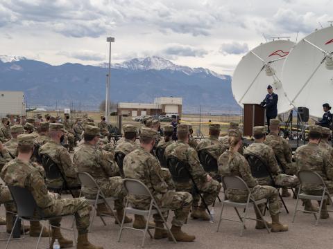
The symbiotic relationship that must exist between industry and the National Imagery and Mapping Agency (NIMA) was explored in depth at an industry day sponsored by AFCEA in January. The event, titled “Involving Business in the Future of Geospatial Intelligence,” was held at the Defense Intelligence Analysis Center, Bolling Air Force Base, Washington, D.C. Agency leaders as well as representatives from the military and homeland security organizations shared their insights with more than 500 conference attendees.
Lt. Gen. James R. Clapper Jr., USAF (Ret.), director, NIMA, opened the sessions with remarks about the changes and challenges within the agency. The fiscal year 2003 budget, for example, includes substantial money for commercial imagery, he said, a multifold increase over past years’ budgets. The primary goal is to provide NIMA’s customers with the images they need, and the agency will go to foreign suppliers for the images if necessary, he stated.
In addition, NIMA is transforming the way it works with companies. Citing his experience in the private sector, when he made presentations to government agencies and did not receive feedback, Gen. Clapper explained that NIMA now has a process in place that tracks contractor presentations, arranges for follow-up visits and provides feedback to companies. “NIMA is entering a new era with the contractor community. We are moving away from quality control and moving toward quality assurance. This means trusting the contractors to do what they promise,” the general said.
Several challenges loom for the agency as the nature of operations and threats change. For example, the location of adversaries has transitioned from fixed sites to moving targets to underground hideaways to the unknown. In addition, in the past, government personnel conducted the majority of intelligence analysis. Today, much of the functional technical expertise exists in the private sector and is being conducted by contractor employees. This trend will continue, according to Gen. Clapper (SIGNAL, January, page 21).
Intelligence gathering techniques also have changed. While past activities involved reconnaissance, today’s technologies, which include unmanned aerial vehicles, support surveillance. This method requires quicker analysis. In addition, data was gathered traditionally from one source, such as humans or radio signals. New capabilities now facilitate the gathering and dissemination of intelligence from a multitude of sources.
Gen. Clapper pointed out that the information and work that has been conducted in the past to assist in foreign operations can now be applied to homeland security missions. However, policy and resource issues still need to be sorted out, he added.
Transformation to Geospatial Intelligence panelists agreed that contractors will play a critical role in meeting NIMA’s customers’ requirements. Thomas Coghlan, director, analysis and production, NIMA, explained that missions are moving faster and require more flexibility. The agency needs cartographers, imagery scientists and analysts, Web developers and engineers, and it will look to the commercial sector for assistance to meet recurrent as well as surge demands.
John Oswald, director, Asia-Pacific Office, NIMA, said that data fusion and analysis development support global readiness. While keeping information current is difficult, it is necessary, Oswald added. His department wants companies to be responsible and provide products that will meet future needs. Imagery and technology that allow fly-through views are not new; what is needed is a way to provide this capability in hours rather than days, he said.
Panelists for the second session, Transforming to a Data-Centric Environment, stressed that data is the core of geospatial intelligence. “Tools you put on the desktop appear agile. But in the end, it’s about understanding where the data is,” said Roberta E. Lenczowski, technical executive, NIMA. The data-centric environment requires information integrity and a database design that enables reuse, production flexibility and scalability.
Barbara Locke, information engineer, NIMA, explained that data models provide a coherent way to see concepts and help keep all projects going in the same direction. In geospatial intelligence, data models provide a common reference so NIMA’s customers know what is available and can view information in a familiar format.
Standards are one key to data modeling, and a three-pronged approach has been recommended for determining what standards should be adopted. First, NIMA must participate in commercial communities that are making decisions about data model standards in both the national and international arenas. Second, the agency must interact with other agency standards management groups. Finally, NIMA must lead the geospatial intelligence community in determining standards. A NIMA tiger team will develop policy and work with businesses to set up the National Center for Geospatial Intelligence Standards this summer.
Panelist JoAnn Cecere, systems engineer, NIMA, discussed the challenges spiral development pose to designing a data-centric environment. In April 2002, a commercial team led by the Raytheon Company was awarded a contract to establish a geospatial information system enterprise that integrates existing databases and production tools to support geospatial intelligence production and dissemination.
Cecere explained that the initial delivery of a Spiral 1 product was due in July 2002; however, it was not delivered until November 2002. Although the teams did not achieve the initial delivery goal, many lessons were learned about the spiral development process.
Cecere related that for this approach to development to succeed, the same people must remain on the team. Expectations for achievements must be well managed, and customers, the government and the contractor must “buy in” to the spiral approach. Program management must focus on a critical path, and schedule dependencies and resource loading are essential. A program calendar must be maintained constantly so that meetings and deadlines can be scheduled and changed as needed without causing chaos. In addition, readiness reviews and milestone processes must be streamlined.
The third panel addressed NIMA’s support of homeland security efforts. How Domestic Customers Use Geospatial Intelligence panelists agreed that detailed mapping information will be critical for both homeland defense and emergency response efforts.
Jack Hild, deputy director, Office of the Americas, NIMA, explained that both the U.S. Department of Homeland Security and the U.S. Northern Command (NORTHCOM) will need the same common operational picture, and data interoperability is critical. Visualization technologies will support security operations as well as disaster response and recovery, he added.
Among the tools required to support homeland security and disaster recovery will be one-meter resolution imagery, and NIMA will work with partners such as the U.S. Geological Survey, the Federal Emergency Management Agency, the Census Bureau and commercial data providers to acquire supplemental data.
Panelist Tina Pinkard, acting deputy chief for the NIMA support team, Department of Homeland Security, explained that NIMA and the department will work together to prevent terrorist attacks, reduce vulnerabilities and minimize damage. To accomplish these tasks, the Homeland Security Department will focus on border and transportation monitoring, information analysis and infrastructure protection, emergency preparedness and response, and science and technology. NIMA will be the value-added data broker and provide geospatial intelligence, she related.
In explaining NORTHCOM’s role in homeland security, Robert Wimer, deputy chief, NIMA support team, NORTHCOM, said the command’s primary mission is to conduct operations that prevent, deter and defeat threats to the United States. NIMA will provide situational awareness to NORTHCOM’s commander through tailored imagery analysis, reporting and services. Geospatial intelligence also will be used in crisis and disaster response exercises and operations, homeland security exercises, and critical infrastructure assessments.
Joseph Drummey, chief, North America and Homeland Security Division, NIMA, explained that the agency currently is in the process of gathering geospatial information about 133 cities, critical infrastructure, and borders and seaports. The goal is to have a NIMA database that organizations like NORTHCOM can use for various purposes.
During the final session of the conference, Transformation Strategy—Theory, Goals and Progress, panelists discussed changes within their organizations. Capt. Gene Arbogast, USN, Office of Force Transformation, U.S. Defense Department, explained that transformation in the military means changing the way the services operate to move from the industrial age to the information age.
The captain emphasized that transformation is a continuing process that requires the armed forces and agencies such as NIMA to anticipate the future. In addition, there must be a co-evolution of the processes, concepts of operations, organizations and technology. “Transformation and modernization are not in competition, but they are different things,” he said.
Steve Selwyn, director for knowledge management, intelligence community, Office of the Chief Information Officer, pointed out that transformation elevates the need for information sharing. Technology can be leveraged to increase intelligence, and the goal is to operate in a seamless enterprise. Formerly, each intelligence organization worked independently. Today, the push is to eliminate roadblocks so intelligence agencies can leverage information that already exists.
Deborah Dunie, transformation program manager, NIMA, said the agency plans to change the way it operates by linking functional and financial areas. The agency’s investment strategy includes supporting current operations and stabilizing and modernizing infrastructure and the work force. Capabilities will be advanced in functional management, information access and resource management. Transformation priorities include soft copy migration, multisource multiple intelligence, global feature improvements and upstream processing. Plans call for establishing a center of excellence for imagery source management so that organizations can go to one place when they need geospatial information.