Ushering Science Into Operations
The organization responsible for finding technology solutions for the National Geospatial-Intelligence Agency’s (NGA’s) toughest challenges, the NGA’s Research and Development Directorate, is balancing speed and development as it advances geospatial intelligence solutions.
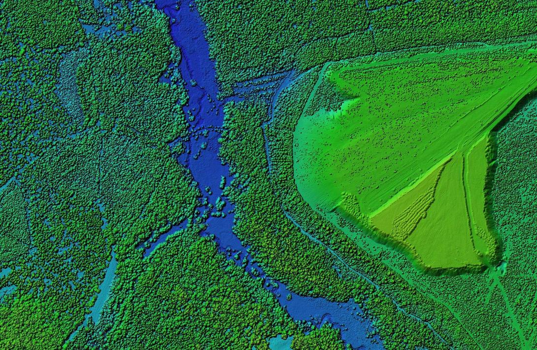
The directorate conducts basic research in technology readiness levels 1-7 across geospatial science, including advanced analytics and modeling, data management, modern software engineering, artificial intelligence (AI) and machine learning (ML), and improved workflow processes, amongst other areas.
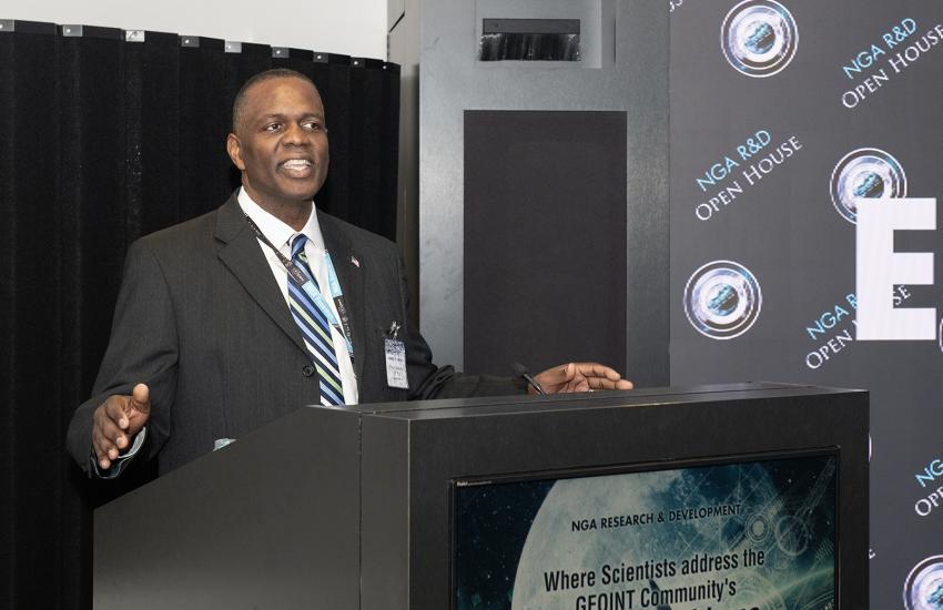
“Our goal from the R&D perspective is delivering cutting-edge geospatial technology to support national security objectives, and how do we move faster from R&D to operations,” said Ronzelle Green, director of the NGA’s Research and Development Directorate, in an interview with SIGNAL Media. “It is also about how do we pull agile acquisition so we can do this cycle faster and give our warfighters advantage. Last year, we transferred quite a few items into operations, and you really focus in on the technology readiness levels, actually doing that basic research, but really focusing on how do we transition these things.”
As a combat support agency, the greater NGA must provide key imagery, intelligence and geospatial information to the Defense Department and the intelligence community. These resources are becoming even more vital for the United States as adversaries are investing significantly in new geospatial intelligence technologies.
Earlier in the year, NGA Director Vice Adm. Frank Whitworth, USN, approved the organization’s move to become the Research and Development Directorate, a measure suggested by Green to reflect the important transition from science into operations in a near-peer environment.
“It is kind of all the above,” Green explained. “It is changing how we are thought of as a directorate. That is a key component. But the real change is looking at our research around these hard problems and making sure our organization fits around what is important to the nation and research.”
Green stepped into his role leading the directorate in September 2023 after being the Atlantic Area Reserve chief of staff (and a captain) in the U.S. Coast Guard. Previously, the R&D director was a senior advisor in the Maritime Expeditionary Security Group II, Navy Expeditionary Combat Command, was the chief information officer for the Defense Counterintelligence and Security Agency, where he led key digital transformation efforts, and was the director of Commonwealth Integration in the Office of the Undersecretary of Defense for Intelligence and Security.
He is no stranger to the intelligence community and the NGA, having been in the agency in various joint duty assignments since 2000. As such, Green understands the threat environment and is also setting a course for the directorate’s visionary priorities, looking now at what will be needed five or 10 years down the road.
“I’m a firm believer that we hire smart people to tell us what to do, looking five, eight, 10 years ahead, for some of these capabilities that we will need,” the R&D director said. “The great thing about our directorate is that we have R&D scientists that are absolute experts in their field, not just in the U.S. government, but they’re experts in the world on geospatial, analytics, cyber, AI, ML. It is about, ‘How do we leverage their thoughts and their intellect and making sure that we’re supporting national security priorities?’”
Some of that R&D focus is developing solutions for bringing information together with other intelligence disciplines—such as open-source intelligence—combining information together to find the operational relevance.
Also, the NGA is looking for artificial intelligence and machine learning capabilities that will help the data-centric agency more effectively and efficiently sift through the increasing volumes of data available from both government and commercial sensors by leveraging automation, Green explained. “For example, we are exploring how synthetically generated data can be fed into machine learning processes to reduce our reliance on manual labeling, while ensuring such synthetically trained algorithms perform to requirements,” he noted. “At the same time, we are ensuring that such automation won’t come at the expense of quality, accuracy or traceability—the stakes are too high for our analysts and warfighters.”
It is the NGA’s Broad Agency Announcement, called Boosting Innovative GEOINT-Science and Technology or BIG-ST, that is the primary vehicle for bringing innovation into the R&D Directorate, however.
“So far this year, we have posted three topics focusing on foundational models, synthetic aperture radar and navigational systems,” Green specified. “In the past 12 months, NGA R&D also competed and awarded the Research Development Contract—a multiple-award contract supporting agency research and development requirements. We currently have five task orders out for bid covering core geospatial functional areas.”
The effort also features grant opportunities for NGA academic partners that are researching synthetic aperture radar, an area of great interest for which the directorate is also reviewing responses.
In addition, the NGA participated in the Small Business Innovation Research (SBIR) 24.2 and Small Business Technology Transfer 24.B programs this spring that included machine learning and full motion video capabilities. The NGA is the only intelligence community agency participating in all phases of the SBIR program, the director stated. And another unique program in the intelligence community is the directorate’s Historically Black Colleges and Universities (HBCU) Faculty Fellows program.
Running in its third year, the program pairs HBCU faculty with NGA R&D scientists to examine key geospatial intelligence technical research areas. In early June, six faculty fellows started their 10-week fellowship, with two fellows returning from last summer’s cohort, Green shared. “Additionally, four faculty fellows from last year have converted to part-time visiting scientists, continuing the collaboration with their mentors,” he said.
The R&D Directorate is also examining ways to harness data and capabilities that apply to illegal maritime activities. Several months ago, the directorate launched an effort to find solutions to help combat illegal, unreported and unregulated fishing, as part of the $1 million Global Fishing Forecast Grand Challenge.
“We partnered with Defense Innovation Unit (DIU) for the unclassified challenge to look at unclassified data to detect illegal fishing,” Green noted. “We put a challenge out to the world that said, ‘Hey, if you have a solution and CONOPS [concept of operations], tell us about your solution and we’ll have a contest.’ We had roughly 23 companies, small businesses, some large business and academia, say, ‘Yes, we have some thoughts of how to track illegal fishing.’”

On May 16, the agency and the DIU’s National Security Innovation Network announced 10 finalists for phase one of the challenge. The finalists offered novel data sources, data visualization, risk analysis, remote sensing and artificial intelligence and machine learning capabilities that could help detect illegal, unreported and unregulated fishing, according to an NGA statement.
Some of the finalists included: the Allen Institute for Artificial Intelligence, which conducts AI R&D in multiple sectors, including the maritime industry; Athenium Analytics, a New Hampshire-based company that leverages AI-enabled imagery analytics, predictive models and proprietary risk scores to identify and manage risk; Esri, which specializes in enabling problem-solving through geographic information system software, location intelligence and mapping; and the University of Miami’s Center for Southeastern Tropical Advanced Remote Sensing that applies civilian synthetic aperture radar, electro-optical and other remote sensing satellite data to geospatial problems.
Each party received $25,000 for being selected, NGA reported.
The second phase of the challenge began May 20 with the finalists pitching their full solutions to a panel of interagency judges. The NGA and DIU plan to announce three winners this summer, with first place receiving $500,000, second place $200,000 and third place $50,000, according to the NGA.
“The novel methods put forward by these finalists introduce fresh approaches for development of new capabilities,” Green said in the statement. “The ability to forecast industrial fishing will help NGA and its customers anticipate IUU [illegal, unreported and unregulated] fishing and inform proactive measures to combat it.”
In another effort to help combat illegal maritime activities, the NGA just launched another commercial solutions pilot to provide direct-to-warfighter commercial techniques for identifying, monitoring and tracking illicit maritime vessel activity in the U.S. Indo-Pacific Command area of responsibility.
“We are using innovative challenges and processes to really go after some of these national security hard problems,” Green shared. “Because we found out it’s not just government that has this intellect. It is also in industry and academia and in the national labs. For us, it is about how we leverage that information, that knowledge and understanding to make sure that we’re meeting the need of the U.S. government and also the department.”


Comments