Growing Geospatial Intelligence Seedlings

The National Geospatial-Intelligence Agency's Research Directorate is increasingly leveraging U.S. industry solutions to fill any gaps in the agency’s capabilities. The directorate is employing a robust array of contracting, partnership measures, infrastructure development and research vehicles to harness emerging technologies and capture innovation in advanced analytics and modeling; data management; modern software engineering; artificial intelligence; and improved workflow processes.
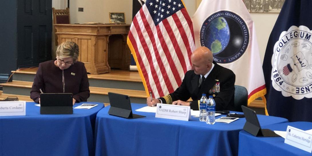
As a combat support agency, the National Geospatial-Intelligence Agency, or NGA, provides key imagery, intelligence and geospatial information to the Defense Department and the intelligence community. This information is becoming all the more vital as near-peer adversaries invest significantly in new geospatial intelligence technologies.
“It’s a new world out there,” says Cindy Daniell, director of research at NGA. “We have to rise to the challenge, and we cannot do it alone. We are looking to form great partnerships across the entire spectrum of the R&D [research and development] spectrum from the very beginning, the nascent basic research that needs to happen out in academia, all the way through the development and test and evaluation, to get it working out in operations in the field.”
In particular, the research directorate is focusing on decreasing the transition timeframe of basic R&D to fielding. “The accelerated science to mission timeline is a big goal for us,” Daniell says.
The research center relies on integrated product offices (IPOs) within the directorate to help shorten that transition timeline and quickly deliver future geospatial intelligence capabilities for the users for operational impact.
“Our goal is to transition,” Daniell stresses. “We work hand in hand with the IPOs who know the requirements of the users and analysts, as well as other customers both inside and outside of NGA.”
The organization is examining new sensor capabilities, how to modernize NGA analysts’ workflows, and how to use artificial intelligence (AI) in a way that is analyst friendly, the director shares. “We need to improve the productivity of the entire human-machine interface, that whole human-machine symbiosis that needs to exist for the tradecraft,” she says.
Given additional information-generating capabilities from emerging sensors and other systems, the center also is researching comprehensive data solutions. “Data is a big issue for our research, because there is lots of data,” Daniell observes. “The analysts don’t want raw data. They want information, so we are looking at AI to help us extract information and give the analysts multiple forms of INT [intelligence], whether it is images, OSINT [open source intelligence], SIGINT [signals intelligence] and all of the other INTs that will help the analysts come to a more intelligent and robust answer.”
Other research areas, such as emerging horizontal geospatial intelligence capabilities, complement the agency’s three priority areas, the first of which is providing foundational geospatial intelligence, detailed information about the Earth, its features and entities, and human geography. “You could think of the Osama bin Laden compound,” the director offers. “Before they were able to get into that compound, they had to know how high the gate was, how many entrances were there, where people were congregating.” The second priority area, sensor phenomenologies portability, investigates “the very unique and interesting things that we can do with sensors that are not necessarily used in their traditional ways,” Daniell says.
Meanwhile, analytic technologies, which accounts for about 40 percent of the directorate’s efforts—with another 40 percent dedicated to phenomenology and the remaining 20 percent to foundational—includes analysis and artificial intelligence, predicting actions, “determining where people are, who is traveling together, recognition of objects, image and video information,” she notes. “We’re looking backward to do analysis and answer key intelligence questions for national security as well as look ahead and do predictive analytics as to what could happen in a specific location and time.”
Construction is underway by the Kansas City District U.S. Army Corps of Engineers at NGA’s West campus in St. Louis for a new $1.7 billion facility that will help support research efforts, among other key NGA operational functions. The facility, which is expected to hold 3,000 people, will open in 2025. In July, the agency opened its first unclassified innovation center, Moonshot Labs. Currently located with T-REX, a nonprofit entrepreneur center in St. Louis, Moonshot Labs will move into a space on the 97-acre West campus when it is completed. Since Moonshot Labs are and will be located outside the restrictions of NGA’s classified facilities, it makes it easier for academia and private industry to collaborate on software development for tradecraft, one of its main focuses, and technology solutions. This will attract capital, and the right kind of capital, the director asserts.
“We’re looking at government and companies being able to integrate together in the same environment in an outside venue, not ensconced in the SCIF [sensitive compartmented information facility] areas of NGA proper,” Daniell emphasizes. “It is an outside area where we’re putting together development code to get these capabilities ready for operations. A lot of the final pieces of the puzzle going into the NGA’s infrastructure are here in St. Louis, which then gets pushed out to all the operators around the entire world, so that’s why Moonshot Labs is located here in St. Louis.”
The labs’ planned collaboration is expected to aid the transition of well-developed prototypes that are closer to operational readiness—at about technology readiness level (TRL) 6. The research directorate will remain part of the larger NGA team at Moonshot Labs and will continue to tackle the technology challenges that need more research dollars, “while leading the way with transfer and transition,” Daniell adds. One such transition effort is the research directorate’s new pilot accelerator program, “a highly competitive pre-acquisition discovery program designed to influence corporate technology while lowering the barrier to entry for small businesses.”
In addition, the directorate is homing in on the acquisition part of the R&D cycle, to “drive forward agile acquisition,” she notes. “Because we have more control over the acquisition, we are trying to really winnow that down and add some best practices from private industry and other DoD agency partners.”
The directorate is pursuing a comprehensive mix of contracting mechanisms. For example, it is using the Small Business Innovative Research (SBIR) program “very robustly” to bring in advanced capabilities, Daniell says.
The directorate generates its own topics for the SBIR contracts. In fact, NGA is the only agency in the intelligence community (IC) to have an independent version of the Defense Department’s SBIR program. “It’s a big deal,” she states. “No other IC agency is doing that. It’s a great addition to our portfolio. And we are welcoming more and more entrants into that SBIR world.”
The research directorate uses the SBIR program to augment its bigger programs. “The SBIR fills the voids inside of a large program that are easy to target,” the director explains. “It is a pretty fast and rapid way to get contracts out. If you are running a large computer vision program, or a large artificial intelligence (AI) program, and the second year into the program we determine that there is a gap in one particular area, then we can send out a topic that is very targeted. The SBIR lets us target very unique and very niche areas that we need to help the larger program.”
The SBIR program also provides a vehicle for commercialization. “And because of that, we get more small businesses to propose,” Daniell observes. “Many businesses will not submit to a BAA [Broad Agency Announcement] but will to a SBIR because they want to have that commercialization aspect, and we can leverage their expertise. So, it is a win-win.”
Moreover, the directorate is using its inaugural year-old BAA in varied ways. Known as the National Geospatial-Intelligence Agency, Boosting Innovative GEOINT–Research Broad Agency Agreement (BIG-R BAA) HM0476-20-BAA-0001, the vehicle is open to industry through July 31, 2023.
First, the directorate pursued specific topic areas of research under the BAA to add certain capabilities to the agency. “We had a radar topic,” she notes. “We had an epidemiological study topic, and we had another topic on nearest-neighbor clustering for image understanding and image processing. We like to use the BAA in that regard, where we scope the problem very carefully and then proposers can come up with unique solutions. We are getting more minds on a problem, and we are getting more innovative solutions that we may not have thought of.”
Next, the research directorate tried a different approach to attract so-called innovative seedlings. The open topic framework identifies the types of problems the agency is facing across its entire portfolio for industry to then be able to submit a broad range of emerging solutions. A TRL of 2 to 4 is the ideal range for the innovative seedlings topic under the BAA. “The purpose of the seedling topic is for industry to identify innovative concepts and advance them toward maturity, while buying down risk,” the director states. “The seedling topic is forward looking in that there are no specific problem sets.”
It hosted its first BIG-R BAA industry day in May—and will host another such virtual event this month—to get industry feedback and answer questions regarding the seedlings method. “It is a key critical part of the R&D spectrum to start with a seedling before you initiate a large program,” Daniell clarifies. “The proposers themselves can come up with the problems that they want to address, and they have started doing that already. We’ve been getting a lot of good white papers in. It provides a lot more freedom for the proposers to utilize and leverage their particular expertise, and we are looking for more of that.”
The organization also is working through the Department of Homeland Security to connect state and local governments with geospatial intelligence solutions that could be used by first responders. “In this whole-of-government approach, we are helping companies and capabilities reach those state and local customers that may be harder to reach around the country,” she states.
As a research arm, the directorate also naturally relies on cooperative research and development agreements, or CRADAs, as well as other transaction authority, which they call OTAs. Both research vehicles can be used by industry, not just academia—a common misconception.
“CRADAs are extremely useful and are a great way to get to know your government partner,” the director suggests. “The benefit of a CRADA to a company … is getting access to things like data. That’s what a CRADA will do for you. And it helps you to understand the agency and be better prepared for other competitive vehicles that you can use.”
And Daniell, who spent years in the private sector, especially understands the importance of the industry’s abilities to bring geospatial capabilities into the agency and to the greater IC. “I spent the bulk of my career in private industry before I came to the government, so I know what it is like,” she says. “I know that it is important to support private industry and their end goals. Industry needs to better understand the Defense Department and the IC so that they can access the resources they need to do their job and provide critical capabilities for national security.”


Comments