Air Asset to Send Critical Material to Forces Faster
The plug-and-play technology will close large capability gaps in the field.
The U.S. Army is developing the first airborne intelligence, surveillance and reconnaissance platform fully enabled to connect analysts with the Distributed Common Ground System-Army. That system will help remedy problems currently hindering soldiers from having all data feed into a single repository. With the new aircraft, the process will be streamlined from the flying support, so information reaches ground commanders faster to facilitate more timely decision making.
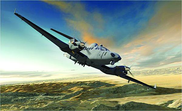
Units will begin enjoying these connected benefits of the Enhanced Medium Altitude Reconnaissance and Surveillance System (EMARSS) aircraft in 2014, with the Army accepting deliveries from Boeing beginning later this year. In the past, all airborne intelligence platforms employed their own unique processing, exploitation and dissemination procedures that transmitted to specific ground stations. Personnel then had to find workarounds to share it with the troops who needed it. Through the Distributed Command Ground System-Army (DCGS-A), analysts can query the single system and retrieve the sensor data remotely.
Soldiers have used the DCGS-A extensively throughout their operations in both Iraq and Afghanistan. However, the Defense Acquisition Executive only approved the system for full deployment across the force in mid-December of last year.
The Army’s Guardrail platform is also DCGS-A capable, but it does not have operators of the system on board nor does it have imagery intelligence (IMINT) capability. Guardrail is designed to support only signals intelligence (SIGINT) to the DCGS-A, while EMARSS will bring in the imagery piece at the secret Internet router protocol network level. In addition, EMARSS will be the first platform that can provide data from secret to top secret immediately into the Army's distributed system.
Lt. Col. Dean Hoffman, USA, product manager, Medium Altitude Reconnaissance and Surveillance Systems at Program Executive Office Intelligence, Electronic Warfare and Sensors (PEO IEW&S), says recent evidence demonstrates that the military is falling short in its ability to collect necessary data in the intelligence, surveillance and reconnaissance (ISR) world. “One thing, we’ve done a lot of studies recently that show there’s a great need, and we’re not meeting all the requirements for the ISR approach. ... ” Col. Hoffman explains. “... I think EMARSS has a key role in meeting these requirements.” The three defining ISR missions sets, according to the colonel, are persistent area assessment; situational development, in which forces identify a problem area where attention is necessary; and mission overwatch wherein the aircraft is used to scout the ground during an operation.
To combat the ISR challenges, the Army needs to find ways to employ additional relevant platforms while remaining prudent with funds in the current environment of limited military budgets. Remaining responsible in a tight fiscal situation involves not only examining requirements and capabilities, but also sustainment issues. Col. Hoffman says solutions involve going to a single base infrastructure, the ability to take sensors on and off without major modifications and using only one means for processing, exploitation and dissemination. “That whole philosophy is what is needed to handle these budget constraints, and that’s what EMARSS is built to do,” he explains.
Col. Hoffman illustrates the problem of having multiple intelligence catalogues instead of the one enterprise the DCGS-A offers by comparing the two options to regular Internet search engines. The previous methods employed by the Army are similar to if people had to go to Bing, Ask and Google to find all of their data rather than querying through only one website. With EMARSS and DCGS-A, information is fed directly into the Army’s chosen intelligence enterprise, allowing users to take full advantage of collected data.
As part of the fielding, the Army has developed a training package to educate users to control sensors via the DCGS-A laptops. Maintenance and sustainment training also will be provided.
Current funding supports production of four EMARSSs, but program officials are awaiting word about possibly financing up to 12 new aircraft modeled on the B350ER platform. Later, the Army is looking at ways it can capitalize on the B350ER aircraft already in the fleet to support EMARSS requirements. “We’re just trying to recapitalize on the investment already made during the war,” Col. Hoffman explains. The B350ER has a long life expectancy—beyond 20,000 flight hours.
The decision to base EMARSS on a manned aircraft instead of an unmanned aerial vehicle could have benefits for ground commanders. Col. Hoffman says remotely operated platforms may be limited to fewer sensors. The altitude and relatively small size also enable the B350ER to support operations in more constricted spaces.
Where the aircraft will go first as they roll out depends on commanders' requirements. The Army will use a complete forward operating assessment to determine if they should deploy to Afghanistan or another theater. Regardless of where the aircraft head initially, Col. Hoffman believes the connectivity they offer will have a serious impact for battle leaders by providing direct support through various intelligence fields, including imagery and signals. These commanders will receive immediate feedback on intelligence requests. Col. Hoffman says that in the past, tasking a specific asset was an option only for division-type levels or higher. Recent conflicts demonstrated the need to give intelligence to field operators more quickly.
Though much of the focus in recent years necessarily has been on the U.S. Central Command’s area of operations, different challenges in other regions are emerging as priorities for the U.S. military. EMARSS is not focused on any specific theater, but built to support commanders regardless of location or threat.
Because ground forces will receive real-time information from the tasked EMARSS aircraft, they can react quickly as situations progress instead of hours or even days later. Col. Hoffman calls it intelligence at the area of operations. Examples of information ground operators could receive include how many people are around an objective, where they are walking, what they are wearing and what communications channels they are using. “Those are several key intelligence factors that we didn’t have the capability to provide in the past,” Col. Hoffman states.
EMARSS also will include plug-and-play capabilities that enable it to support different missions—another lesson learned from more than a decade of active war. “Often we were building aircraft around sensors rather than sensors around aircraft,” Col. Hoffman says. Soldiers found that when a new sensor deployed downrange, they had no way to install it on platforms. Now the Army wants to develop a single, sustainable platform that can accommodate different sensors as missions dictate.
Sensors that could ride on the aircraft include those for wide-area surveillance, short-wave infrared and Light Detection and Ranging, or LIDAR. Col. Hoffman says service officials will release information to industry stating the type of sensors they need so companies can develop solutions that fit the right specifications. Then, soldiers in the field can plug in the relevant pieces as necessary without having to modify the aircraft.
The focus for PEO IEW&S at this point is to equip EMARSS with SIGINT and IMINT capabilities as well as precision geolocation. Other future capabilities already under consideration include wide-area surveillance synthesis, aperture radar, ground movement tracking indicators, dismounted target movement indicators and hyperspectral sensors. Part of the development process includes ensuring that the information is collected through the right data process and goes to the correct file so it can be ingested into the DCGS-A enterprise. The executive office is working with the Joint Interoperability Test Command, the Intelligence Information and Warfare Directorate and the Software Engineering Directorate, as well as with industry, to begin integrating the sensors.


Comments