U.S. Navy Must Keep Geospatial Intelligence Afloat
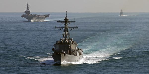
The U.S. Navy has outsourced geospatial intelligence at sea, delaying its investment in a solution to this core intelligence competency for the afloat commander. The service needs to train its analysts to produce geospatial intelligence and acquire software and hardware for them. A cost-effective systems solution exists, but the lack of commitment to geospatial intelligence holds the Navy back.
The National Geospatial-Intelligence Agency’s (NGA’s) “ship rider” program has proved that afloat geospatial intelligence is both feasible and necessary. The program, which has been active for two years, places civilian geospatial analysts on large-deck warships to enhance geospatial intelligence, or GEOINT, and demonstrate its full-spectrum power. But even with this effort, the Navy may be no closer to achieving a permanent and sustainable afloat GEOINT solution.
The ship rider program’s original intent was to influence the Navy’s training programs to emphasize GEOINT for fleet operations. Today, the service is expanding the program, focusing on providing visualization, analysis and dissemination of fused views of the operational environment. GEOINT is a force multiplier for the Navy, bringing imagery intelligence and geospatial analysis, mapping, charting and geodesy into one discipline. Geospatial products provide a distinct and tailored view of the battlespace, which creates a shared understanding of the operating environment across the levels of war.
When the USS George H.W. Bush strike group deployed this year with an NGA rider, the importance of developing mapping products that better support planning became immediately obvious. More than mapping was needed. Geospatially oriented intelligence was displayed in a series of data layers using an easy-to-read Adobe format called a geospatial PDF. The NGA analyst improved understanding of the operating environment and the concept of operations products.
Georectified maps with exact ranges, distances and movements quickly replaced cumbersome and less accurate PowerPoint maps. Additionally, the geospatial PDFs provided the ability to customize each map by turning on and off separate geographies, threats and environmental layers, allowing planning teams to explore the interactions of maneuver in physical space and in the electromagnetic domain. A single geospatial PDF, the Air and Missile Defense commander noted, could be used across all major warfare areas, and the consistency in graphics enhanced overall situational awareness of the operating area. Accessible to the entire strike group, the geospatial PDFs also are used by other task forces and maritime headquarters.
The strike group embarked on data collection in the Arabian Gulf to create GEOINT visualization products that could be shared with the maritime operations center and future strike groups. Validating NGA data on maritime obstructions, oil platforms and traffic separation schemes was easy. The merchant traffic, fishing and oil infrastructure support patterns took observations over several weeks. The data was organized using the NGA rider’s systems and training, and it was visualized through multiple layers in a geospatial PDF created using the rider’s ArcGIS and TerraGo software.
Synchronizing the operations center and strike group staffs streamlined operational tasking and planning. No longer were the tasks assigned to the strike group incongruous with the constraints of the operating environment. The power of GEOINT is in the operational environment synthesis it generates, which provides a unique competitive advantage for every afloat commander.
One of the ship rider’s goals of training the imagery analyst in the art of GEOINT quickly identified the shortfalls of GEOINT at sea. The first NGA rider deployment in 2015 noted the primary challenge as a lack of bandwidth, but the real challenges are data collection and management. Systems, software and training are required to make data useful. Understanding data management practices is vital when building layered geospatial products. Even with the proper software, tailored visualization products cannot be built without the knowledge and ability to manage, store, discover and/or create spatially enabled data.
This creates a dilemma for the Navy. The service cannot manage the data without the systems, but it does not want to buy the systems until it knows how to use the data. The Distributed Common Ground System–Navy (DCGS-N) is the program of record that provides intelligence, surveillance, reconnaissance and targeting (ISR&T) support capability. The 2011 incremental improvement of the DCGS-N focused on adding GEOINT capabilities as part of the system’s first increment. Unfortunately, these improvements fell short, and the second increment, planned for the last fiscal year, has yet to be fielded.
In addition, the Navy’s Integrated Imagery and Intelligence (I3) applications support analyst workflows and tactical intelligence processing. I3 provides the NGA’s digital map and imagery exploitation capability to the afloat unit. The geospatial information system (GIS) software suite envisioned for I3 is intensive and takes a fair amount of training to achieve its full capability. Even more concerning, it is costly.
The NGA rider program demonstrated that ArcGIS suite, TerraGo Publisher and one analyst can provide effective GEOINT. Under the current NGA rider construct, access to NGA systems and software is the biggest benefit. But that access is temporary—when the rider departs, the equipment and access do too.
The Navy has outsourced GEOINT at sea to the NGA to overcome a lack of system resourcing and tradecraft training. Outsourcing may be a short-term answer, but it cheats the Navy of the core capabilities it needs in its afloat architecture. Interorganizational cooperation with the NGA should not result in permanent civilian NGA riders as a substitute for a trained Navy work force. The other services already have embraced GEOINT and trained enlisted personnel as GEOINT analysts.
The Navy Enlisted Classification (NEC) is the Intelligence Specialist (IS) 3910 imagery analyst. The 3910 is only trained to conduct first-phase imagery analysis. Today’s demand to understand human and electromagnetic domains requires more in the areas of GEOINT visualization and fused views of the operating environment. The Navy’s afloat intelligence capability has not kept up with the changing character of war.
Navy officials know that the service needs GEOINT at sea. The question is how to get it. Operational intelligence functions afloat remain an integral part of the strike group. Some make the case that afloat intelligence cannot adequately satisfy the wide range of requirements with only organic capabilities. Command and control in a denied or degraded environment (C2D2E) means that using reachback may not help either. Working with the complementary capabilities of other members of the intelligence community to strengthen the role of naval intelligence is important, but not if that means sacrificing its core capabilities.
Afloat intelligence support is a core competency because the complexities of the modern maritime environment require it. This support is essential to successful military planning and execution. But relying on the NGA’s support is unsustainable. Each NGA rider requires at least two additional NGA employees for assistance, along with information technology and deployable systems. When it comes to GEOINT, the NGA likely wants to teach the Navy to provide its own.
The presumption also persists that outsourced work is better and cheaper than in-house, but that is not always true. At this point, continuing the NGA rider program without installing a permanent software suite of tools and providing the associated tradecraft training for sailors only defers the cost to the NGA. After more than two years of the program, the afloat GEOINT concept appears to be sound, and it is time for the Navy to invest in it.
The NGA rider program’s original goal was to train and mentor the afloat intelligence team to use GEOINT. This goal is unattainable if every NGA rider brings GEOINT systems and leaves with them. By now, the Navy should have the necessary systems and software, and the NGA rider should be arriving with knowledge and experience to provide advanced, mission-focused training, not only equipment, if the Navy is truly to develop afloat GEOINT. The Navy does not need to wait for the second increment of DCGS-N to make this approach a reality.
For about $20,000 in systems and licenses, the service can provide basic GEOINT to a carrier strike group until the second increment of DCGS-N is fully developed and fielded. The short-term proposal is straightforward: Provide two high-end laptops to each strike group’s intelligence specialists with the latest Windows operating system, the basic Microsoft Office load, the standard ArcGIS suite with the TerraGo Publisher for ArcGIS and the GeoRover extensions, along with authorization to connect to classified networks.
Because the Navy likes programs to fund systems, expanding the Intelligence Carry-On Program (ICOP) to create and manage the GEOINT laptops separately might be an easy solution. Developed through the Unit Level Rapid Technology Transition (RTT) program, ICOP is a system that brings intelligence and analytical capabilities as well as unit-level ISR processing, exploitation and dissemination to surface operations. The ICOP’s use of RTT is a perfect fit for the GEOINT laptops, and the program’s mission to integrate commercial and government off-the-shelf applications with shared storage and communication paths lends the ICOP to managing these deployable laptops. Through the ICOP office, GEOINT laptops could be developed, controlled and issued to the strike groups.
Each carrier strike group receives four to five intelligence specialists as part of its fleet intelligence detachment. These 3910s are some of the best imagery analysts in the fleet and easily trainable in GEOINT practices. As part of their predeployment training, send them to the NGA College for basic GIS and data management instruction. Send the strike group’s other IS NECs (3924 and 3923) to the NGA College for this training as well, or request mobile training teams from the NGA College. While at the fleet intelligence detachment, 3910s could leverage the NGA Support Team (NST) for additional follow-on training as needed.
The finishing course could be deployment with an NGA rider. After a few months at sea, the rider would return to the NGA, where he or she and the Navy NST could continue to mentor the afloat team through reach-back support. This model embraces the intent of that first NGA rider deployment in 2015. After a few years, Navy intelligence would have a cadre of GEOINT-trained analysts that could support development and growth of GEOINT throughout the fleet. The core competency of geospatial intelligence would be preserved, not outsourced, and the NGA would be part of interorganization cooperation instead of an outsourcing agent.
With a few simple changes, the Navy could dramatically improve its GEOINT capability and provide the afloat commander with a competitive advantage. The NGA rider program has proved that a single analyst with the right tools can produce custom GEOINT products that greatly enhance carrier strike group planning and drive operational decisions. As the only service yet to fully embrace GEOINT, the Navy is failing to get ahead of the complexities and multidomain character of modern warfare. Embrace GEOINT now and stop waiting for the DCGS-N upgrade to field the capability. Turn the NGA rider program into an interorganizational victory that gives the Navy a better chance to win the nation’s wars at sea—not another outsourced gap filler.
Cmdr. Bryan Leese, USN, is a career intelligence officer and an instructor at the National Intelligence University. He was Carrier Strike Group 2’s N-2 during the George H.W. Bush Carrier Strike Group’s deployment this year to support Operation Inherent Resolve.
Brooke Wright is a geointelligence analyst with the National Geospatial-Intelligence Agency. She provided specialized geospatial products to Carrier Strike Group 2 on its recent deployment to support Operation Inherent Resolve.


Comment
In my opinion geospatial
In my opinion geospatial intelligence is really necessary. its a really good news. Well done US NAVY. Keep Going
Comments