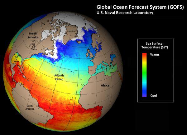
U.S. Naval Technology to Aid In Ocean Forecasts for Public
The National Centers for Environmental Prediction (NCEP) has teamed with the U.S. Navy to use naval technology to better forecast ocean currents and possible dangers that now can be employed for commercial and public use, according to a press release.
The National Centers for Environmental Prediction (NCEP) has teamed with the U.S. Navy to use naval technology to better forecast ocean currents and possible dangers that now can be employed for commercial and public use, according to a press release.
NCEP, part of the National Oceanic and Atmospheric Administration, provides public environment forecasts and now will use software developed by the U.S. Naval Research Laboratory (NRL) to acquire data to maintain daily forecast accuracy for safe, at-sea operations, hazard mitigation, resource management and emergency response. “This is an example of complementary missions across agencies that, through coordinated application, leads to protecting our service personnel, who ensure the high seas are safe, and protecting our resources and citizens at home,” says Gregg Jacobs, director of the NRL’s Ocean Dynamics and Prediction Branch. “Development of an advanced global ocean prediction system has been a long-term Navy interest. This use of Navy-developed systems for global ocean forecasting represents dual-use technology that will benefit civilian interests and is an excellent example of the cutting-edge research that is enabled through Navy-sponsored investments.”
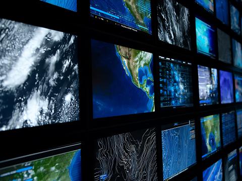
The Naval Meteorology and Oceanography Command, which oversees the Naval Oceanographic Office, provides ocean environment forecasts using meteorology and oceanography, satellite and in situ monitoring systems and geospatial information and services. The Navy then uses the collected data for strategic, tactical and operational battlespace planning.
The Navy predicts the ocean environment to estimate acoustic propagation, placement of sonar arrays, determining currents for mine drift and burial, drift for search and rescue, and safety of operations on and under the ocean surface, the release states.

Comments