Situational Awareness During Homeland Disasters
 |
Brig. Gen. Christopher Coates, CF (l), Continental United States North American Aerospace Defense Command Region deputy commander, is greeted by John Salvador (2nd from r), Civil Air Patrol (CAP) National Headquarters assistant executive director, at CAP’s National Headquarters at Maxwell Air Force Base, Alabama. Gen. Coates presented CAP with five Geospatial Information Interoperability Exploitation-Portable (GIIEP) go kits courtesy of Air Forces Northern. GIIEP is designed to improve situational awareness and information sharing among the military, National Guard and state, local and tribal authorities. |
In the battle to share information effectively among local, state and federal partners, the National Guard Bureau has employed a tool designed to give personnel an edge. This geospatial information technology is deployed across the United States and its territories, enabling better coordination during emergency situations. With Google Earth as its base, it already has proved valuable in large-scale responses, and officials are planning future improvements.
The Geospatial Information Interoperability Exploitation-Portable (GIIEP) is predominantly a geospatial information service, but it also includes go kits, which contain communications and visual record-making tools for use at the scene of an incident. Thomas Merrill, the National Guard Bureau’s GIIEP program manager, explains that the system is hosted in North Dakota at a U.S. Geological Survey office. Project personnel have populated a Google Earth globe—a plug-in that allows users to navigate and explore geographic data on a three-dimensional globe via a Web browser—with imagery interpreting all 54 states and territories where the Guard has units. Merrill says GIIEP is “very recent; it’s very accurate; and it’s trusted.”
GIIEP also pulls in information from other government sources such as U.S. Northern Command’s Situational Awareness Geospatial Enterprise. Merrill describes that as a treasure trove of information that National Guard task force commanders, units and state partners can pull data from during incidents. Another source is the Homeland Security Infrastructure Program (HSIP) Gold, which gives National Guard leaders and state officials the ability to look at infrastructure in their areas. During response to a violent tornado that hit Joplin, Missouri, responders accessed satellite data to see the scar caused by the storm, then overlaid information from HSIP Gold to see what infrastructure had been damaged or destroyed. GIIEP also incorporates sources providing near-real-time weather data.
Though the National Guard has been using GIIEP in full deployment for more than a year, it continues to increase the system’s information sources and uses. “There are many, many other government partners that we’re bringing in,” Merrill explains. One of the new partners is the Federal Aviation Administration. GIIEP partners now can pull data from and provide data to that organization. Commanders can learn about temporary flight restrictions or other similar actions.
With the system, various incident responders within a state are able to access decision-making resources more quickly, and everyone retrieves the same information. State National Guard authorities can hand out software to their local and tribal partners along with user names and passwords. When those groups turn on their software, the capabilities are available for them on the Internet. Merrill says that for users, the resource looks the same as Google Earth, but actually the data resides on a government website.
The go kits hold the equipment to enable much of the on-site information gathering and sharing that populates GIIEP. Each National Guard Joint Forces Headquarters has received two kits. Distributed Common Ground Station units also have received some, and the National Guard Bureau has a set for training purposes. Each kit contains a ruggedized laptop with a cell phone connection and a 3G connection, a satellite telephone, a handheld video camera and a still-frame camera. The still frame can provide the longitude and latitude of the image and is Global Positioning System-capable. It also will record the direction it is pointing. Basically, it tracks “all the metadata that an analyst would need,” Merrill states.
The video camera can give the location of the video, which can be stitched onto the Google globe. A Rover 4 receiver pulls full-motion video from unmanned aerial vehicles and feeds it into the computer and then into GIIEP, enabling decision makers to see the video in near real time, Merrill explains. He adds that video taken with GIIEP does not look the same as a Predator feed. “It’s not designed to,” he explains. But it does offer a first-blush view of conditions to officials.
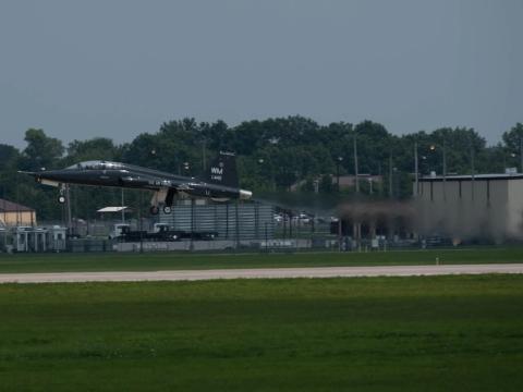
Which pieces of the go kits would travel on an aircraft depends on the room available and on the mission. The Civil Air Patrol, which flies many of the GIIEP missions, has trained aerial observers and photographers who can employ the cameras, or the National Guard can send its own personnel. “It’s the option of the units involved,” Merrill explains. One concern for everyone using the technology is protecting the privacy of citizens as well as complying with all laws, regulations and directives. Merrill says that personnel go to great lengths to ensure that people’s rights are protected. Users also have to respect state sovereignty. Each state maintains its own information but can give another state permission to access it.
GIIEP has proven valuable during natural and manmade disasters across the United States. Merrill says it was brought to bear during the Deep Water Horizon oil spill crisis, when the full-motion video asset assisted incident commanders and decision makers obtain aerial photographs. He explains that the system gives incident commanders a ready asset, saving them time because they no longer have to call other states or services to obtain information.
Merrill also says the system is easy to employ. Regarding the Google Earth portion, “Any analyst can go in there and start using it very, very quickly,” he states. Nonanalysts should pick it up within a day or so of training. On the hardware side, personnel generally learn how to assemble and operate it in about a day and a half.
 |
The GIIEP go kits include self-contained communications equipment and other hardware that enable full-motion video, digital imagery and in-flight chat capability with federal, state and local emergency operations centers supporting emergency situations. |
As more partners begin employing the system, it will grow in usefulness. “We are going to be sharing open-source information between agencies, and this will be of mutual benefit to everyone involved with the program,” Merrill explains. His organization is talking with the U.S. Coast Guard, which he says wants to field it soon to obtain a remote sensing capability. Other agencies also have expressed interest in the system.
The multiuser nature of GIIEP is reflected in its development. Though the National Guard Bureau owns the system and served as the operational manager for the development effort, the U.S. Army Space and Missile Defense Battle Lab provided the technical services to integrate and deliver the system along with an integrated training program. The bureau’s J-2 supplied the original system requirements and maintained responsibility for coordinating information access agreements with numerous domestic event response partners. David K. Cox, chief, Integrated Missile Defense Division, Space and Missile Defense Battle Lab, explains that, “The GIIEP system was developed for the National Guard Bureau to support its incident awareness and assessment mission.”
The lab already had developed and demonstrated many of the network-centric information-sharing capabilities the bureau and its partners wanted in their system. Personnel primarily used commercial and government off-the-shelf products they had adapted to meet the needs of military and civilian first responders in the Defense Support of Civil Authorities (DSCA) mission. Other partners involved in the effort include the U.S. Air Force’s A-2 staff, the Air Force Electronic Systems Center and the 1st Air Force, which falls under Northern Command. According to Cox, Air Force organizations took part in all aspects of the project from the point of refining requirements to providing access to data sources such as commercial satellite and other overhead imagery products as well as evaluating the utility of the system.
“The GIIEP system addresses several capability gaps that were identified by the National Guard Bureau as a direct result of requirements identified in lessons from the Hurricane Katrina response mission,” Cox says. He adds that, “This system provides each state and territory headquarters with the tools to organize the best available relevant unclassified information such as geospatial products, facilities, response assets and infrastructure information in advance of domestic events, so the information is available when required in an accessible sharing environment.” GIIEP also enables on-scene responders to provide timely and accurate information to decision makers at operation centers where response activities are being planned and coordinated.
GIIEP integrates Space and Missile Defense Command’s Advanced Warfare Environment (AWarE), AWarE Video Elements and Virtual Alabama software products. “Each of these systems had been designed to experiment with different aspects of information sharing to support military command and control,” Cox says. They provide unique capabilities such as video management and exploitation, friendly force situational awareness, datalink interfaces and high-quality geospatial viewers that had been evaluated in experiments and used as a contingency capability to support warfighter needs. When integrated, the software met the requirements articulated by the bureau’s J-2 and could be delivered as an integrated system quickly; in this case, approximately one year.
Lab personnel coordinated with the bureau to send mobile training teams to each state’s Joint Force headquarters and the four U.S.-territory National Guard headquarters. The teams provided operator training including a series of operational vignettes. “The training was phased to ensure that states with potential events such as the Midwest floods and Gulf-Atlantic hurricanes were fielded as early as practical,” Cox explains. “This was primarily an integration activity since most of the individual components were open-source systems that had been previously evaluated in Army and Air Force experimentation.”
The most challenging aspect of the integration was designing the system to meet U.S. Defense Department information assurance standards while supporting effective information sharing with the National Guard’s numerous civilian first-responder partners at all levels, he adds. Both Cox and Merrill say the technology has been well-received by Guard units and their partners.
The Battle Lab continues to provide technical and sustainment support to the bureau. It also supported use of a developmental version to the Coalition Warrior Interoperability Demonstration. There, personnel exercised and evaluated it in a series of DSCA scenarios. Though intended for and so far used only in homeland missions, the geospatial system does have other potential applications. In principle, it could solve problems with processing, assessing and disseminating unclassified full-motion video and geospatial information products with nonconventional foreign allies and with partners responding to overseas humanitarian assistance and disaster situations.
WEB RESOURCES
GIIEP: https://www.giiep.us
Civil Air Patrol: www.gocivilairpatrol.com
Space and Missile Defense Command: www.army.mil/smdc
National Guard Bureau J-2: www.ng.mil/jointstaff/j2/default.aspx


Comments