Mobile Spectrum Tool RadioMap Moves to the Marines
The U.S. military is moving an advanced radio-frequency mapping capability from the laboratory into the hands of warfighters. Developed by the Defense Advanced Research Projects Agency, the technology will give land-based forces vital situational awareness of the radio spectrum as they fight on an increasingly digitized battlefield.
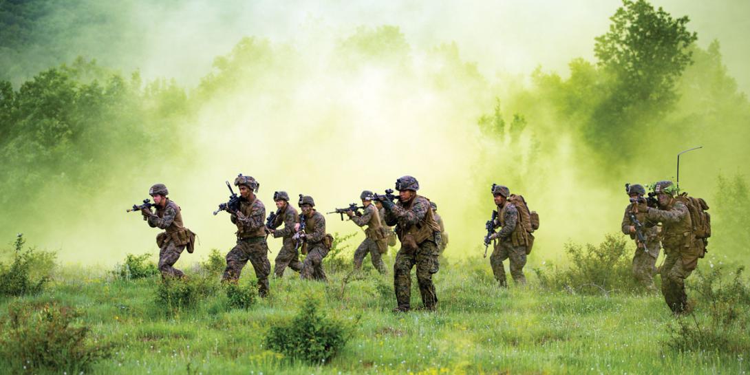
Facing daily threats in an ever-changing operating environment, warfighters need a quick way to assess the digital topography. And for modern-day soldiers and Marines fighting in dense urban environments, this means having a read on the spectrum.
Until now, warfighters lacked a mobile expeditionary system to manage the radio spectrum. Often, capabilities to assess radio-frequency (RF) usage in a certain area are tied to a command post. Small tactical units traditionally do not carry such specific monitoring equipment.
The Defense Advanced Research Projects Agency’s (DARPA’s) Advanced RF Mapping program could change that. The program’s groundbreaking technology, known as RadioMap, gives expeditionary Marines and soldiers real-time awareness of radio spectrum use across frequency, time and geography, according to DARPA.
An important feature of the technology is its versatility; it can be used with radios in the field as well as with other devices. “It can be used by almost anything that is a sensor, even commercial-off-the-shelf stuff like a Raspberry Pi,” says DARPA’s Joseph Evans, program manager, Strategic Technology Office, who oversaw the RadioMap program.
The role of the U.S. military’s research agency in developing RadioMap ended April 30, and the program is moving to the U.S. Marine Corps, its primary transition partner, Evans notes. The Advanced RF Mapping program, which began in 2012, was originally meant to increase awareness of improvised explosive device (IED) triggers. “As we’ve moved forward, we’ve learned that there are lots of uses for this basic situational awareness capability,” Evans shares.
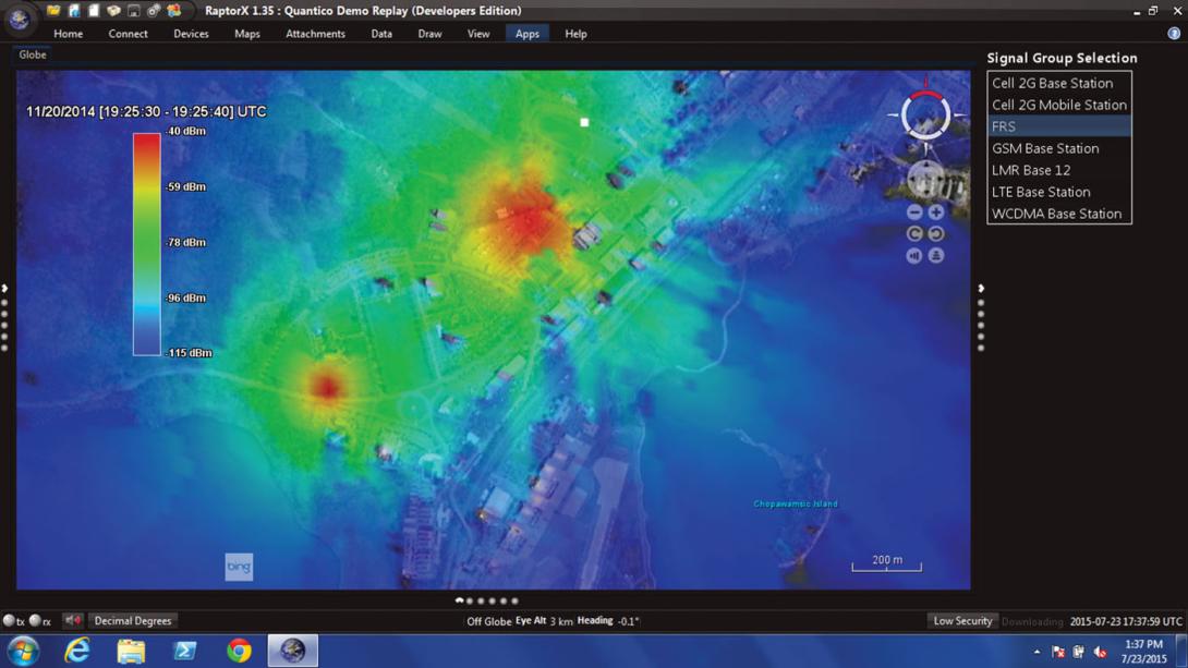
DARPA likens RadioMap to a traffic camera “that shows the flow of traffic at different times of the day, giving real-time awareness of whether a section of road is jammed with traffic or clear, helping drivers plan their commute.” RadioMap gives an accurate picture of spectrum use “in complex environments,” according to the agency.
The tool isn’t designed to reveal the details of specific radio transmissions. Instead, it identifies frequency usage, “allowing better planning and allocation of the spectrum to warfighters overseas operating in RF-congested environments,” the agency states.
With this knowledge of the RF environment, warfighters then can assess how they will use that spectrum awareness to their benefit. “Right now, we are just getting to the first level of spectrum management. It is getting an [initial] sense of what is out there and if there is an emitter in a particular frequency band, in a particular location that seems odd. It is finding a way of figuring out what that is,” Evans explains. “RadioMap is pretty groundbreaking for [spectrum managers]. It is finding the unknown unknowns.”
In addition to spectrum deconfliction management and tactical uses, DARPA found an unexpected application for the technology. “One of the funny things that came out of our exercises down at Quantico was that we had a communications network that someone was using, and they just could not get the darn thing to work,” Evans recalls. “[The Marine said], ‘I think I’m on the air, and we had RadioMap up at the same time, and looking at it, there was nothing radiating over there, so [we saw he] couldn’t possibly be on the air. There was no emitting energy. And it turned out that the radio was broken. It was a wonderful debugging tool.”
Evans explains that the technology for RadioMap is based on three levels of software. First, the specific RadioMap software focuses on the heat map and the RF situational awareness, displaying information so that a Marine or a soldier can understand what is going on in the spectrum environment, he says. “If it’s a high-powered emitter, it shows as a hot area on the heat map, and if it’s low power, it’s a cooler color,” Evans says. “It allows you to see geographically where things are emitting in the RF spectrum.”
Then, the middle-level software, called WALDO—for wireless and large-scale distributed operations—manages the sensor network. It handles messaging between the sensors at the top-level applications and how much network throughput is in use. The software also identifies how much of the resource at the lower level, or sensors, is in use and what the sensors detect in terms of frequency ranges, according to Evans.
The lower-level software turns devices into sensors. “It is the software that goes into the tactical sensors themselves, such as radios, jammers—pretty much anything that can sense the RF environment,” Evans stresses. “The key part is that the software allows those devices to continue doing what they are doing. So if they are a radio, they stay a radio, with minimal to no impact as to what they are doing as a radio. If it’s a jammer, again, minimal to no impact on that functionality.”
As for any limitations of the technology, he suggests that it “really only is the limitations of the sensors themselves. So if you have good sensors, you have good situational awareness, and if not, you don’t.”
RadioMap has caught the U.S. Army’s attention as well. Evans confirms that experimental work with the service “was to explore how easy it would be to integrate it into their systems,” he says. In a recent exercise, the Army successfully downloaded the software, integrated it and ran it with some of the systems the service has been developing for an electronic warfare planning and management tool, Evans notes.
Giorgio Bertoli, senior scientific technology manager for the Intelligence and Information Warfare Directorate (I2WD) within the Army’s Communications-Electronics Research, Development and Engineering Center (CERDEC), acknowledges that CERDEC is certainly “leveraging programs like DARPA’s RadioMap program that are pushing the envelope” in situational awareness.
The Marine Corps is managing the RadioMap software repository on the Defense Intelligence Information Enterprise (DI2E), a shared software site, for other services to access if needed, Evans notes.


Comments