
The Long Game for First Responder Interoperability
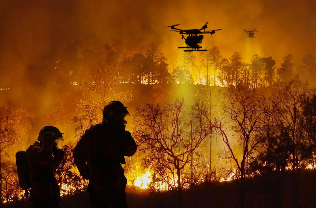
During the Great Baltimore Fire of 1904, when almost half the city burned, resulting in 1,500 buildings destroyed and $3.6 billion in damage in today’s money, first responders saw first-hand the issues of interoperability. Firefighters from different firehouses came from all over to assist the city in putting out the fire. The problem: different-sized hoses that could not all fit into the city’s fire hydrants.
It is a lesson that the National Institute of Standards and Technology, or NIST, and its Public Safety Communications Research Division (PSCR) still see as relevant today.
“We were formed in 1901 and one of our first tasks as an agency, our first national task, was the Baltimore Fire of 1904,” explained Rebecca Jacobson from NIST’s public affairs. “It was a devastating fire. One of the problems was that all of these firefighting agencies from outside of the city of Baltimore rushed in to help, but none of the hoses could connect to the fire hydrants because they were all threaded differently.”
NIST was tasked with solving that interoperability issue, and then, 100 years later, with September 11, interoperability was still a problem, Jacobson noted. “It was just with a different technology,” she said.
One of the issues on 9-11—when terrorists hijacked and flew planes into the Twin Towers in New York City and the Pentagon in Washington, D.C.—was that the first responders could not communicate, given technology gaps and interoperability issues, PSCR Division Chief Dereck Orr told SIGNAL Media.
The PSCR, which is part of NIST’s Communication Technology Laboratory and now operates from NIST funding, has several of its own research laboratories.
“What became evident during 9-11 and at the Pentagon that day, and then with Hurricane Katrina, was that we had these technologies that were deployed across the country, owned oftentimes agency-by-agency with very different life cycles,” Orr explained. “You had these large technology gaps. And you also did not have a uniform implementation of the standards across the technologies.”
Twenty-five years later, the PSCR is still pushing for interoperability, standards and technological advancement. “This R&D for public safety is a long game, and it takes a lot of iterative steps,” the division chief noted.
The requirements for standards need to be developed, and this means participation in standards bodies over decades, along with the formation of testing processes and capabilities.
For example, the PSCR continues to be involved with the global standards for cellular mobile networks under the 3rd Generation Partnership Project (3GPP), which is working on Release 20 and is expected to roll out in mid-2027.
Release 20 will cover standards for advanced 5G capabilities like artificial intelligence (AI) and machine learning for smarter network operations, non-terrestrial networks, immersive augmented and virtual reality (VR) environments and sensing-as-a-service. It also begins the study of 6G AI-native network architectures, post-quantum security and integrated sensing and communication.
Because of the commercial emphasis of mobile communications, the 3GPP standards—and subsequent products and capabilities—are not necessarily designed with public-safety communications in mind, Orr emphasized. “They were not thinking about things like mission critical or push-to-talk, because commercial customers do not use that,” the division chief shared.
In addition, the PSCR’s work creating test cases against the standards helps inform the test processes and capabilities of the measurement and instrument industry. And as of last year, third-party laboratories around the world can leverage testing equipment and run public-safety test cases for certification and testing of 3GPP standards that otherwise would not have existed.
The result is an ecosystem of experts, companies and laboratories that are now testing and using the standards that the PSCR began in 2016-2017.
“That is something that we are really proud of as a program,” Orr shared.
With Land Mobile Radio (LMR) remaining a central capability to public safety communications, the PSCR is now working to pair LMR with other sophisticated capabilities designed to help public safety officials and first responders the minute they enter a building.
This includes the work of their Mission Critical Services (MCX) portfolio, which examines four communication areas: direct mode, mission critical push-to-talk, LMR to LTE, and public safety user quality of experience.
“Mission-critical services [are] growing to encompass voice, but also video and other data services, and it is no longer just land mobile radio; it is also broadband devices,” Orr said. “And a lot of that is focused on getting the remaining capabilities from LMR radio that do not currently exist on broadband devices, onto those devices, so that public safety could, if they wanted to, simply respond with a broadband device and have it function the way they would expect their LMR radios to function.”
One of the most important mission-critical features that the MCX lab is working on for first responders is direct mode—the ability to talk device-to-device without a network, sometimes called D2D. The LMR capability is great for this application, as cellular devices would require a connection to a cellular network, Orr said.
Under a cooperative research and development agreement with San Diego-based Qualcomm, officials from the PSCR’s MCX are exploring the company’s Sidelink technology that implements direct mode.
“We are working with them in our lab to understand their first iterations of Sidelink and how it will apply to public safety operations,” the division chief explained. “That is really exciting to see this thing that we started working on a decade ago, and now see it in a prototype device from a major company that wants to partner with us and understand how it meets public safety’s needs.”
Another key area in mission-critical voice that builds on the PSCR’s work from 2004 is understanding how to measure the user experience through voice intelligibility.
“Commercial customers think of voice as a quality or sound as quality, high fidelity, and it usually is talking about the richness of the sound,” he clarified. “We are worried about the intelligibility because sometimes you can have really high-quality voice, but maybe the first part of the sentence is clipped, or the end is clipped, or you drop a part of the center of it.”
The current efforts are turning voice intelligibility into a test platform that can automatically test intelligibility levels or other key features that public safety cares about. This includes mouth-to-ear latency—when a firefighter hits the push-to-talk button on their LMR, how long does it take to get through the network and to the ear of the other person?
“We can now apply it to things like LTE, when you take an LTE device and cross-connect it to LMR,” Orr explored. “Or when you use a satellite to bridge devices together, all of those change the network parameters, and to be able to tell public safety this is what it means for you for intelligibility, this is what it means for connectivity. That is a really important metric for them, because delay matters ... and we need to be able to quantify that.”
The PSCR is providing this intelligibility data, along with a measurement mechanism, back to industry and academia for further improvements.
Next, the PSCR’s Location-Based Services (LBS) research is advancing indoor mapping, tracking and navigation, building on efforts started in 2017 to make sure solutions improve and evolve for modern devices.
“There is an expectation we all have that is, ‘I can see where I am on a map. It can help me get from one place to another,’ but what happens to public safety when they walk inside of a building?” Orr asked. “All of a sudden, they do not have GPS inside of a building, but they need to track personnel and assets. It is really important. We have firefighters die every year just feet from a doorway, because they did not know that they were that close, nor did the command know where they were.”
The mapping, tracking and navigation solutions provide fine resolution, down to the millimeter, and do not require preexisting equipment in the building to deploy. “They should be able to deploy and track themselves in a 100-year-old warehouse, and not just in smart buildings built five or 10 years ago,” he emphasized.
The location-based research is also centering on first responders’ unique tasks and mapping them during those activities.
“What we have seen is a lot of success in understanding that a person’s gait is very unique,” Orr said. “So, we have researchers placing sensors in each of the heels of the boots of the responders. And where they were losing location accuracy is when they were doing things differently, like a first responder might have to do. They have to walk backwards sometimes; sometimes they have to crawl; they have to drag victims out of a building backwards.”
Just a few months ago, the PSCR opened a brand-new test site in Boulder, Colorado, called the Z-Axis Test Facility. It provides the PSCR labs, industry and public safety officials the ability to test solutions that track altitude down to millimeter-resolution floor-to-floor—versus along an X-Y plane, across a floor.
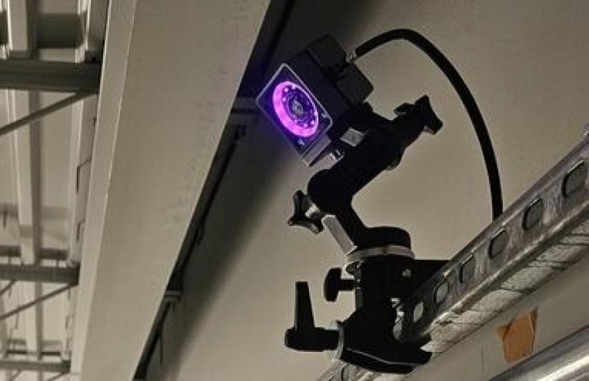
The Z-Axis Test Facility is a four-story functional stairwell with 52 high-speed optical cameras that allow the PSCR to measure at every millimeter of the stairwell, from top to bottom, Orr said.
“You need a ground truth test platform to test [solutions] to understand how accurate [they are],” he stated. “They can tell us where they think they are in the stairwell, but we can tell them exactly where we know they are in the stairwell down to the millimeter.”
A lot of the new public safety mapping, tracking and navigation technologies are sensor-based—using sensors such as accelerometers—leverage intelligent algorithms, and are evolving further with AI to annotate maps in real time. It goes way beyond initial lidar tools.
“As they are mapping in real time, AI could be labeling every sprinkler head they are walking by, every fire pull they are walking by,” Orr shared. “And it is just happening in real time behind the scenes. We are seeing a lot of exciting opportunities with having AI become this real-time annotator of the data.”
And nowadays, with unmanned aerial vehicles sometimes considered the “first responder” in disasters or events—going before firefighters, police and public safety officials to get a clearer picture of what is happening and reduce the initial risks—the PSCR’s Uncrewed Aircraft Systems (UAS) portfolio features research on drone communication technologies that can operate effectively in complex mission-critical environments.
The division chief noted that the UAS research goes beyond dropping an EpiPen or a life vest to a victim or interacting with those in need and letting them know someone is on the way or tracking a suspect.
“What is different about drones for a first responder program is that it requires nonvisual line of sight [operations],” Orr said. “You need to be able to send that drone beyond where the controller is, and they need to be able to track and operate the drone. Our research right now is focused on understanding what those communications links are when you are sending a drone out for potentially a very long distance.”
The PSCR is taking measurements around the radio-frequency signals between the drones and the operator, and potentially in the future, with other drones or even swarms. They are creating models and datasets to advance understanding of how the drones would be able to operate when out of sight.
Lastly, the PSCR’s user experience (UX) portfolio creates tools for first responders based on their specific tasks and requirements—such as heads-up displays, VR and augmented reality. The goal is to envision and create enhanced interfaces, put them in front of public safety and perform research around which solutions are going to actually enhance their capabilities and iterate quickly.


Comments