One Space Imaging System to View Them All
Researchers working on behalf of the U.S. intelligence community are kicking off a program designed to develop a revolutionary capability for monitoring objects in geostationary orbit, including functioning satellites and hundreds of thousands of bits of space debris. The program will attempt to provide low-cost approaches for passive ground-based interferometric imaging of space objects, a technique using two or more telescopes or lenses.
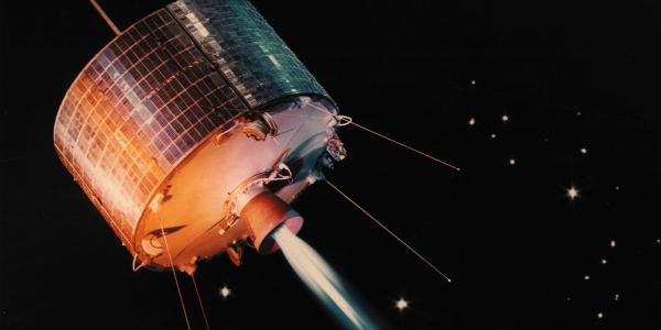
Objects in geostationary orbit are more than 22,000 miles above the equator, and because they follow the Earth’s rotation, they appear to be stationary to observers on the ground. That area of space is crowded with thousands of objects as more countries launch satellites for a number of purposes, including communication and navigation.
Some of those satellites have grown old. Some have ceased to function properly, or at all. Objects both natural and man-made—defunct satellites, pieces of booster rockets, lost astronaut tools and even an empty spacesuit—form a veritable junkyard floating around the planet.
The U.S. Air Force and NASA track thousands of pieces of space junk. The sheer number of objects presents a hazard to existing and future satellites. Making matters worse, small objects traveling at hypervelocity—several kilometers per second or more—can pose a grave danger to spacecraft. Paint flecks have been known to damage space shuttle windows.
“When near space was largely populated by the relatively limited assets of the United States and the former Soviet Union, the potential for unexpected space events was fairly low,” points out Merrick DeWitt, program manager for the Intelligence Advanced Research Projects Activity (IARPA) Amon-Hen program. “Now, there’s a lot more material up there. There are many more space-faring nations that are going up there, and there’s a lot more commercial stuff up there too.”
The technology will be used to observe U.S. and international satellites as well as space junk. “We like to monitor the health and status of our own satellites. As a result, any debris that’s out there—space junk—is of interest because that debris poses a risk for our satellites and other people’s satellites as well,” he adds. “And if our satellites are acting in odd ways, or they’re starting to malfunction, that potentially poses a risk to our other satellites.”
The Amon-Hen program takes its name from J.R.R. Tolkien’s The Lord of the Rings novels. In Tolkien’s fictional language called Elvish, Amon Hen translates to “Hill of Sight.” It is a high hill on which the protagonist, Frodo, can see clearly for miles and miles in all directions. “Amon Hen becomes an obvious allusion for what we’re trying to accomplish: clear imaging of very distant objects in geosynchronous orbit,” DeWitt explains.
Monitoring objects so far from the Earth’s surface requires either very large lenses or a series of smaller lenses all working together. “The problem that we face in imaging small, dim objects like those out at geostationary orbit is that the size of the primary mirror or lens required is too large from both engineering and cost perspectives,” DeWitt says.
Which is why Amon-Hen will rely on a technique known as interferometry, a method DeWitt compares to CT scans used for medical purposes. “An interferometer replaces that very large primary mirror with smaller apertures spaced at relatively large distances,” DeWitt says. “Imagine a really large primary mirror, like 100 meters diameter. Now imagine instead of that being one solid piece of mirror, it’s a composite of a whole lot of smaller segmented mirrors. That’s the first step in thinking about interferometry.”
But, he adds, the mirrors must be precisely engineered to work with each other. “The positions of all of the mirrors have to be within a few tens of nanometers of a specific mathematical shape in order for that focusing to work out properly. If the shape of the mirror is wrong, then the mathematical process doesn’t form and provide a clear image,” the program manager elaborates.
Some state-of-the-art interferometric telescopes use the same approach. The Navy Precision Optical Interferometer (NPOI) at Lowell Observatory in Flagstaff, Arizona, is one example. The NPOI uses an array of up to six mirrors spaced tens to hundreds of meters apart to precisely direct multiple beams of light.
The NPOI can measure the precise positions of stars across the sky, which the U.S. Naval Observatory in Washington, D.C., uses as a reference system for determining positions on Earth and in space and for time keeping. When finished, the interferometer will span the distance of more than four football field lengths—430 meters, according to a Lowell Observatory website.
Another system, the Magdalena Ridge Observatory Interferometer (MROI) being built in Socorro County, New Mexico, will have 10 telescopes located on three arms. Each arm will have nine stations where the telescopes can be positioned, and one telescope can be positioned at the center. The telescopes and their enclosures will be moved with a customized crane.
Although they aspire to one day provide high-resolution images, the NPOI and the MROI are not capable of the kind of resolution that IARPA hopes for. DeWitt says two conventional telescopes now being built will do the job, but they are expensive.
The Giant Magellan Telescope to be constructed at Las Campanas Observatory in Chile will be 10 times more powerful than the Hubble Space Telescope, and the sensibly named European Extremely Large Telescope, also in Chile, is supported by 17 nations.
“Once you consider the cost of infrastructure and all that, all of these systems, both the conventional telescopes and interferometers, are multibillion-dollar ventures. We’re hoping to cut our costs by at least an order of magnitude. We hope to go further, but at least an order of magnitude,” DeWitt asserts, adding that it remains to be determined just how low costs might go.
The program manager expects to award contracts no later than the end of this month. A variety of companies and organizations, including Northrop Grumman, Pratum Labs, the University of Maryland and the University of Dayton Research Institute, have expressed interest in the program. “We received a number of proposals. We were able to find several that merited going forward into negotiations,” DeWitt reports.
He indicates that recent breakthroughs in interferometric imaging make Amon-Hen a real possibility. He cites the Defense Advanced Research Projects Agency’s (DARPA’s) Galileo program as one example. The program uses fiber optics to dramatically increase the speed at which interferometric images can be produced. “The methods by which existing facilities transport light is much more cumbersome and much more costly. Fiber optics are now a prudent capability for potentially reducing costs,” DeWitt says.
Still, fiber optics is not the only solution. “That fiber optic capability is an example of an advance that we’re exploring, but it alone isn’t going to get us down to the much greater than an order of magnitude decrease in costs that we’re hoping to achieve,” DeWitt says. “I don’t know exactly what those advances are. We’re going to have to invent new ones.”


Comments