Megacity Warfare a Warfighter's Nightmare


Some U.S. Army officials and other experts warn that the nation’s military may one day have to do something militaries throughout history have tried to avoid: fight in major cities. Urban combat, in many ways, neutralizes any technological advantage, but some technologies, such as robots and 3D learning maps, could still provide an edge.
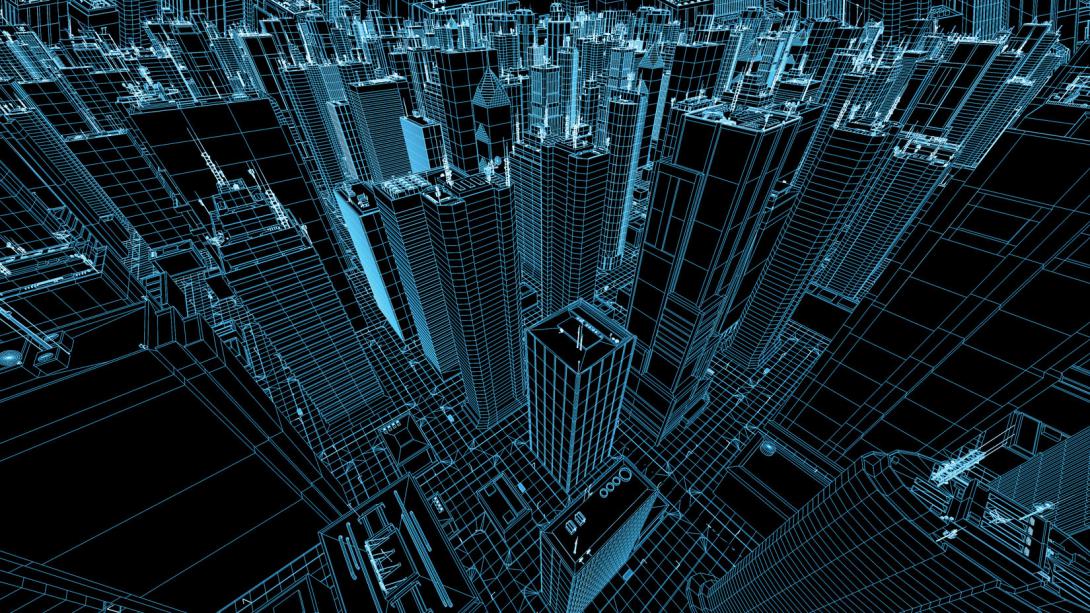
Urban combat, even in smaller cities, is the most complicated, chaotic, brutal and bloody form of warfare. But experts increasingly caution that it is only a matter of time before warfighting in megacities—cities with populations of 10 million or more—becomes necessary.
Part of the reason for the growing consensus is the sheer number of people moving into cities. The United Nations reported in 2016 that nearly 55 percent of the world’s population now lives in urban areas. That percentage is likely to increase to 68 percent by 2050. The urban migration means that city populations are booming, and the number of megacities is projected to grow from 31 in 2016 to 43 in the next 12 years. That’s one new megacity every year.
Omar Lamrani, senior military analyst at Stratfor Enterprises LLC, a geopolitical intelligence company, describes urban combat as a slog in which soldiers fight street to street and door to door and suffer many casualties. He also describes this type of warfare as the great equalizer. “If you have a really powerful military on a standard battlefield, the technological superiority is going to be very apparent against a weaker enemy, and it will generally deliver decisive results,” Lamrani points out. But in urban combat, “that edge in capabilities diminishes significantly.”
He says U.S. and allied forces had significant advantages, including intelligence, surveillance and reconnaissance (ISR) and command and control, during recent battles in the Iraqi cities of Mosul and Ramadi. These urban areas are heavily populated but not megacities. “It still took months of slogging battles to be able to defeat an enemy,” Lamrani notes.
Urban warfare presents an array of command and control challenges. Specifically, the ability to maintain the necessary situational awareness can be significantly degraded.
Skyscrapers can block the electromagnetic signals needed for communications. Myriad other signals—for cellphones, emergency services and other tactical networks—can interfere. Furthermore, much of the fighting in cities is done either indoors or underground, in sewers or subway tunnels where communications don’t work well.
“The technological superiority where you can see and strike the enemy from very far away is largely diminished in a close-in urban fight. You don’t know if the enemy’s just behind the door or in the street,” Lamrani says. “The collateral damage aspect is much more present, especially nowadays, when we think about civilian casualties and the effect it can have on propaganda efforts.”
Compared to a board game, urban combat is more chess than checkers. “Urban fighting is a three-dimensional fight. You’re not only talking about moving forward and backward and left and right, you’re also talking about going up or down a skyscraper, and then you’re talking about subterranean as well,” Lamrani explains.
A subterranean fight complicates matters even further. “Forces can move around very quickly. They can pop up at your back. Logistics becomes an issue because you never know where the front line is exactly,” Lamrani states. “So, being able to maintain that situational awareness becomes a much more difficult task.”
Communicating underground also is troublesome. “It raises all kinds of problems for communications. You can probably make it work for a squad, for instance, but having that communication link all the way back to battalion headquarters becomes much more complicated,” Lamrani notes.
He predicts that U.S. forces will depend even more on robotic systems to maintain an edge in megacity warfare. Ground systems, for example, can provide the ISR capabilities for situational awareness in buildings or underground. Unmanned aerial vehicles, such as miniature helicopters, can be used to establish communications relays. Cyborg bugs developed largely for search and rescue missions could provide situational awareness, the military analyst allows.
“If you’re going to storm a building, the risk is much higher even against a relatively untrained force because they can be laying an ambush or have a house-borne improvised explosive device, a booby trap. Having a dependency on the robot—with a man in the loop, of course—to check out the building can make life much easier,” Lamrani says.
Robert Davis, senior scientific technical manager and chief scientist for the geospatial research and engineering business area of the Army Engineer Research and Development Center, agrees that megacity combat will present a command and control nightmare. Exacerbating the warfighters’ dilemma is the possibility that they will be persistently monitored not just by enemy forces but also by the population itself. “It depends which way the population swings. A pair of binoculars, a cellphone and a $5 bill gets pretty good ISR on what we’re doing, especially if it’s a kid. We’ve seen this over the past 10 years,” he says.
Davis and others in the Army science and technology community are researching ways to help warfighters navigate major cities during military operations. Most geospatial data solutions—the commonly used Google Earth, for example—do not map the insides of buildings or subterranean areas. “The trouble with terrain data in urban areas is that it’s hollow—there is an inside and an underneath,” Davis points out.
Soldiers need to know every place within a building or a tunnel that potential enemies could hide or maneuver, or stash munitions and supplies. Furthermore, they have to be able to navigate when major landmarks change, such as when buildings are reduced to rubble. And they must be attuned to other potential dangers in a city environment, everything from traffic jams to the presence of chemical facilities. “We are also looking at how to characterize things that change dynamically in a city that soldiers need to be aware of: where the people are, where the bad stuff is, like industrial chemicals and toxic materials. You don’t want to get into a firefight around a chlorine plant,” Davis notes.
Just as important, however, soldiers must avoid being overwhelmed by data. Rather than receiving a detailed digital blueprint of a building, warfighters may need to know only the basics. If told they are entering a commercial office tower, for instance, they will instantly understand that they need to deal with multiple entry and exit points and that bathrooms are centralized. In condominium towers or apartment buildings, on the other hand, bathrooms are “all over the place” and exit and entry points are limited, Davis explains. “There are fundamental differences in the interiors of those structures that would help them understand how to effectively conduct an operation like clearing the building.”
Depending on the mission, some warfighters may need even less information. “Oh, by the way, long-range precision fire guys who might want to put a round through the third-floor window to get the sniper don’t need that much information,” Davis offers. “We’re looking at doing a lot of research on use cases and the minimum information that gets the exact effects the warfighter is after.”
Future warfighters may use a device capable of generating a 3D map with up-to-date information, some of which may be provided by the very sensors the soldiers carry. “We are looking at … whether those sensors also serve a terrain data-generation purpose for the cases where there are gaps in the data or a building fell down, or something like that,” the scientist reports.
Eventually, soldiers might even be armed with a 3D map that Davis calls a recommender system. It will be context-aware, meaning that it will understand factors such as its immediate surroundings, the soldier’s orders and the user’s behavior patterns. He likens it to a commercial system that might try to calm down a user who has heart issues and is pushing too hard during a morning run, or a system that could ask whether something is wrong when an elderly user is sitting in the parking lot for several minutes rather than entering the grocery store. “I’m an old guy, and I can imagine needing some help when I start to get demented. I may need a context-aware map helper on my smartphone in 20 years,” Davis suggests.
In a megacity military operation, the recommender system will know enough about its user to recognize when the soldier is in danger of blowing the mission. “The last thing you want to have happen is mission degradation because people don’t get to the right place at the right time,” Davis offers.
For the system to work, it would ascertain user behaviors through training exercises, mission rehearsals or use cases before an actual mission. “We want the system to learn enough about … that user so that in terms of spatial orientation and spatial understanding, you can anticipate issues with spatial cognition and provide just the right cue tailored to that person to get them back on track. That’s the end state here,” Davis says. “It’s a learning map.”
Scientists could make significant progress on a first-generation context-aware mapping system within five years, while a more sophisticated recommender system might take up to 12 years. It is a challenge, in part, because of the sheer volume and variety of data to process. “The megacity case is simply the toughest challenge out there,” Davis declares. “My assumption is that we don’t want to just flatten a city for the sake of getting an adversary. Otherwise, it wouldn’t be much challenge at all. You just call in the long-range fires and squish it flat.”


Comments