China Taps Many Resources For Coastal Defense
The interception of a U.S. Navy EP-3 signals intelligence reconnaissance aircraft over Chinese coastal waters early last year highlighted the activities of the People’s Republic of China coastal defense forces, which have been low-profile and largely remain so today. Such interceptions and intrusions over Chinese waters and nearby coastal areas have occurred for decades, as with the former Soviet Union. In addition to the expected People’s Liberation Army Navy assets, a surprising array of non-navy units are integrated into offensive and defensive military coastal roles, in part because the People’s Republic of China has no force comparable to the U.S. Coast Guard. These units include coastal air defense as well as nonmilitary naval forces from a variety of paramilitary organizations.
Although the People’s Liberation Army Navy (PLAN) numbers many vessels, not many are suitable for coastal defense missions. Fleet and air defense headquarters are co-located with nonmilitary air traffic control, the State Oceanic Administration (SOA), the Civil Aviation Administration of China and scientific headquarters. This highlights close control and coordination of these assets by the People’s Liberation Army (PLA) to meet coastal defense requirements. Inclusion of these additional sensors, aircraft and ships greatly increases the capability of Chinese coastal defense beyond order-of-battle listings commonly used.
Coastal defense forces also have been used in expansion into other nation’s waters. This includes intrusions into Japanese waters by northern units and aggressive operations around the Spratley and Paracel islands by southern fleet vessels.
One of the most impressive coastal defense team operations occurred in October 1994 by the Qingdao naval air team. A USS Kitty Hawk antisubmarine warfare team near the Korean coast engaged a Han nuclear attack submarine. Some Chinese naval F-6 fighters were vectored out to aid the submarine and return to Qingdao. This operation extended beyond coastal radar range and suggests satellite use by controllers.
Harassment of non-Chinese aircraft by F-8 interceptors also has occurred, such as with an RC-135 reconnaissance aircraft in April 2000 over the East China Sea and the well-publicized collision with the EP-3 near Hainan one year later. Harassment of the survey ship USS Bowditch by a PLAN frigate in March 2001 forced the Bowditch to depart the area. Two months later the same ship was buzzed by a PLAN long-range patrol aircraft in the Yellow Sea even though an Aegis cruiser, the USS Cowpens, was escorting it at the time.
More recently, this past September saw renewed Chinese harassment of the Bowditch. Y-8 and Y-12 coastal patrol aircraft buzzed the ship as it operated in the Yellow Sea 60 miles off the coast but within China’s self-claimed—but internationally unrecognized—200-mile exclusion zone. Chinese intelligence-gathering vessels also approached the Bowditch, but they did not interfere with its passage.
Public perception might view the score for U.S. surveillance and People’s Republic of China (PRC) interceptor losses as PRC 1, United States 0. In fact, China’s actions against U.S. coastal intrusions date back to a PRC MiG-15 fighter downing an RB-45C in 1950. Until 1959, seven U.S. aircraft were shot down by fighters, and two were downed by anti-aircraft fire in 1952 and 1953.
The first reconnaissance aircraft downed by an SA-2 surface-to-air missile was an RB-47D in 1959. Between 1962 and 1967, Chinese SA-2s downed six U-2s flown by Taiwanese pilots. From 1964 to 1970, 18 U.S. drones were shot down, two of them in May and August 1965 over Lingshui airbase in Hainan. For various reasons such as the advent of satellite electronic intelligence (ELINT) and photo reconnaissance, the shooting down of intruders has decreased to negligible levels since the 1970s.
China divides its top-level air districts into air defense zones. Each zone comprises sectors and subsectors, which consist of individual radar sites, anti-aircraft gun and/or missile batteries. Although it appears that naval air interceptors would be better at performing over-water navigation and interception, one reference states that in the eastern-fleet area air force fighters are used because of their closer airfield location.
Larger patrol aircraft also have been used for spotting offshore intruders. The first two of four PLA Air Force (PLAAF) ELINT modified Tu-154M aircraft are based in the Nanjing Military District. Additional units are expected for the North and South Fleet duties. Y-8X maritime patrol versions of the Russian four-engine turboprop AN-12 reportedly have shadowed U.S. P-3Cs off the coast beyond F-8 loiter range. Air defense aircraft and pilots, whether air force or naval air force, are among the best that China has, although it is surprising that Su-27 fighters are not used. The first regiment of Su-27s was received in 1992.
Coastal area radars also are the heart of China’s Observation Communication Force, which may be more under naval rather than air force control. In 1986, ITT Gilfillan sold China some Falcon coastal defense radars with an operations center. Since 1993 China has procured the Russian S-300, which is rated among the most capable in the world. Russia has sold 35 Tor SA-15 surface-to-air missile sites to China since 1997, and China is now producing them under license. Other coastal areas have older Russian air defense radars such as the SA-2 Spoon Rest that were exported to all Iron Curtain countries. Massive Yagi long-range search radars include Cross Slot and Moon Cone. Chinese-designed JY- series 3-D coastal radars are the 350-kilometer range JY-8 and lower-level JY-9 gapfillers. The South China Sea now is under surveillance by a new Chinese over-the-horizon backscatter radar with a 700- to 3,500-kilometer range in a 60-degree arc.
The employment of dual-use exports is a key element in China’s coastal air defense. U.S. and European high-technology companies have sold China long-range tracking radars for key east coast airline routes, which happen to be valuable military areas as well. In 1978, Thomson-CSF sold six LP-23 long-range radars for the 700-mile-long corridor between Shanghai and Beijing. The same deal included three TA-10 area radars for military bases in Shanghai and Beijing. China introduced an indigenous-design Type-796 air route surveillance radar that is solid-state and features anticlutter and moving target indicator displays. Under the 1990 Marco Polo program, Alenia sold five primary and 11 secondary radars for 11 airports along the east coast of China by 1995. Although Western radar exports are sold to civilian air organizations, 85 percent of PRC air space is still under PLA control.
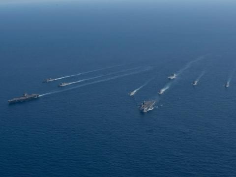
PLAN is divided into three fleets: the North Sea Fleet with headquarters at Qingdao, the East Sea Fleet with its main base at Shanghai, and the South Sea Fleet with headquarters at Guangzhou. Many of the warships and auxiliaries are not large blue water vessels, and most of their exercises and operations are in what would be considered coastal waters. If detection and interception of air or surface intruders is considered a primary coastal defense mission, the few dozen large destroyer-type units are too valuable to be used for such tasking. The approximately 40 frigates could barely meet radar and communication equipment needs for such coordinated work, although a frigate was sent to drive off a survey ship. The vast numbers of patrol craft are limited to visual detection and minimal high frequency radios. In fact, most Chinese naval units spend most of their time in port, and they largely have missions other than surveillance as fleet tasking. Of the hundreds of fleet units, less than two dozen Russian-style AGI and intelligence ships are really equipped for surveillance and evaluation to alert coastal defense assets.
Most authorities on China’s coastal defense would list the active fleet naval assets and not include several other organizations that overtly or in a lower-profile manner directly support coastal defense. This is done through direct government control and coordination of scientific, research, civilian and educational assets to meet military needs. One of the best offshore visual detection platforms is the ubiquitous junk. They are everywhere, numbering in the thousands. Junks even have directly aided Chinese military actions, especially in the Taiwan Straits, where they provided concealment for PLAN warships.
China’s Maritime Border Defense Force (MBDF) also is divided into three eastern coastline fleets that include six military regions that consist of 10 government provinces. The MBDF has four subcomponents, which are Customs Service, Marine Police, Border Security and Border Defense. Because they provide income for the state, the customs units are usually newer and include helicopters as well. Reports indicate that many customs crews are staffed by PLAN members. Border Security units also have command linkage with the PLA’s large People’s Armed Police forces.
MBDF is broken down into three militia groups. The northern MBDF group is made up of the Shenyang, Beijing and Jinan military regions and is titled Shenyang MBDF. Shenyang MBDF vessels have the letter “S” in front of their unit number. This can be confusing because PLAN survey vessels also have “S” hull designators. The eastern MBDF is the Nanjing military region and is called Nanjing MBDF. It is made up of the Hangsu, Zhejiang and Fujian provinces, and its vessels have “N” designators on their hulls. The Guangzhou MBDF guards the southern coast, and its vessels have “G” hull labels. The region used to include Hainan, but it is possible that Hainan and South China Sea islands could be reorganized under separate defense control.
MBDF vessels are scattered among large ports, small ports, military exclusion waters and any other waters as required. For example, the Nanjing MBDF units include Huludao- and Shanghai II-class patrol craft, Yuling medium-size landing ships, Yuchin landing craft ships, Yukin landing craft–mechanized N2332, Youzhong-class cable ships N2304 and N2404, Fuzhou-class coastal tankers and armed trawlers. The other two MBDF fleets have a similar mix of civilian vessels and ex-navy landing and patrol craft.
Because the PRC has no organization with the function of the U.S. Coast Guard, the government also uses groups that are allegedly civilian in purpose to monitor coastal waters. Many similar organizations in the United States fill scientific or commercial functions, but the Chinese structure reveals a very military role. The SOA, for example, has three branches that closely parallel PLAN fleet structure, right down to the headquarters location. The main SOA and PLAN headquarters are in Beijing, and the three fleet headquarters for each are also co-located, and not by chance. A block diagram structure with a ship and aircraft dispatching center, controlling a brigade of marine surveillance ships and a brigade of marine surveillance aircraft, would certainly be a military organization. China claims the three SOA fleets are structured this way for oceanographic scientific purposes. The only variation is that the SOA South Sea Branch’s surveillance vessels are the 7th Fleet, whereas the SOA North Sea Branch and East Sea Branch surveillance vessels are in the 1st and 4th Brigade, respectively.
Another part of the SOA could directly support coastal surveillance and tracking by the Marine Environmental Forecast Service satellite network. The headquarters is in Beijing, with primary coastal stations located in Qingdao, Shanghai, Guangzhou and Haikou on Hainan Island. In 1993, Chinese satellite receiving stations were established at Zhongshan near Shanghai, Changcheng on Hainan and the Great Wall Antarctic observation station. Chinese and U.S. National Oceanic and Atmospheric Administration/Tiros ocean surveillance satellites have been utilized. The PRC launched its first weather satellite, Fen Yung 1A, in September 1988, but it failed after 39 days. An improved Fen Yung 1B weather satellite was launched in September 1990.
In addition to the other nonmilitary naval craft that patrol around key ports and coastal areas, several major oceanographic universities have more than two dozen research vessels that have operated in sensitive areas and supported naval activities. They provide innocuous cover to various government missions. Major oceanographic centers are located at SOA and PLAN control centers and ports.
James C. Bussert is employed at the Naval Surface Warfare Center, Dahlgren, Virginia, where he works on surface ship antisubmarine fire control systems with commercial off-the-shelf technology upgrades.


Comments