Access, Not Oil, Fuels China's South China Sea Policy
China’s encroachment in the South China Sea for more than 40 years has much more impact on freedom of navigation and international confrontations than on pursuit of resources. While it has been staking territorial rights to oil- and gas-rich island regions also claimed by multiple countries, the Middle Kingdom has been employing maritime forces ranging from fishing boats to Coast Guard and People’s Liberation Army Navy (PLAN) vessels in ways that suggest expanded control over oceangoing traffic.
Several nations have produced centuries-old maps showing their claim to various South China Sea (SCS) islands and shoals, and many international agreements were made that were broken or nullified decades ago. Yet, China’s claim of oil rights in the Paracel and Spratly Islands are baseless because all proven and probable reserves are far north and south along shorelines of various claimants. The claim that China is seizing islands as fishing shelters or weather posts does not align with the military weapons, radars and communication in place on those islands.
One third of the world’s trade passes through the SCS, and of course oil field discoveries there are a factor in renewed claims by China. The definition of Chinese exclusive economic zones (EEZ) under the United Nations Convention on the Law of the Sea are the heart of the anti-access/area denial (A2/AD) effort legality. Five nations with conflicting oil field claims in the SCS are Vietnam, Taiwan, Malaysia, Brunei and China. In 2002, China signed the nonbinding declaration of conduct in the SCS with members of the Association of Southeast Asian Nations (ASEAN). Efforts to implement those ASEAN principals since 2009 still have not been signed by China in 2014.
China is in conflict with the Philippines over drilling in Reed Bank, also designated SC 72, and in the Malampaya field, 148 kilometers (80 miles) and 85 kilometers (56 miles) respectively from Palawan Island. Similar oil fields range from 100 miles (field 15-1) to 400 miles into the SCS from Vietnam in waters contested from 2003 up to the present. Despite China’s optimistic projections of oil and gas in the Spratly and Paracel Islands, no oil fields have been confirmed there yet. But possession of the SCS and key islands and atolls can enable China to close access by other nations to existing producing fields along with sea line of communication by other nations in the SCS.
China’s A2/AD policy in coastal seas has expanded to areas much further afield past the so-called first island chain from the Aleutians to Japan and south to Borneo. In May 2009, China presented the United Nations with an SCS map of claims that overlapped waters of other Asian nations. These overlapped areas were marked by nine dashed lines. However, the initial motivation for controlling foreign naval access to Chinese ports has historical justification for when European colonial sea powers claimed many Chinese ports as “open ports” no longer under Chinese control, with various treaties forced upon China.
The 1842 Nanjing Peace Treaty after the first Opium War turned Hong Kong and five other ports over to Britain. The Treaty of Aigun in 1858 gave Russia land north of the Amur River, and the Treaty of 1898 led to Europe occupying dozens of Chinese ports. Weihaiwei and Guangzhou went to Britain, resulting in the Boxer Rebellion and the siege of Peiping/Beijing in 1900. These are still remembered by China as unjust foreign aggressions against ineffective Chinese Ming and Qing dynasties.
These were shameful chapters in history in a time when Chinese people were exported—sold as slaves—and opium was imported to China. The seizure of large portions of China, such as the Shandong peninsula and Mongolia, still are very much alive in the minds of the Chinese people and their government.
Today, the title of Chinese fortifications and function has evolved from 1980s ”typhoon shelters” to their current “oceanic weather station” nomenclature. The best example of the step-by-step expansion, including what the additional sensors and capabilities are, is of Mischief Reef in the Spratly, or Nansha, island group. In December 1995, the Philippine government announced that China had built fortifications on Mischief Reef early in February 1995. Initially three octagon huts, each on pilings, were grouped with common 2.5-meter satellite communication dishes. In 1995, the first two structure groups were located on the north and south section of Mischief Reef.
In late 1996, two more structure groups were started at the east and west sections of the reef. These consisted of five octagon structures each, but they featured no cement main building. In 1999, the latter two sites were dismantled, leaving the original two expanded sites at present on Mischief Reef. The northern installation is the second longest fortress structure in the SCS at 122 meters in length. The two-story building faces a pier large enough for destroyers to moor. The southern fort is a more typical 36-meter-long structure. By 2007, a larger new building was completed.
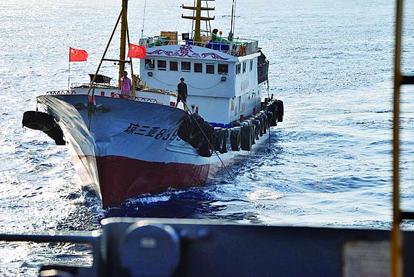
In 1999, the Philippines grounded an old landing ship tank (LST), the Philippine vessel BRP Sierra Madre, on little Second Thomas/Ayungin Shoal eight miles from Mischief Reef. This originally resulted only in conversation, with no confrontation taking place on resupplying it. But earlier this year, four Chinese Coast Guard ships attempted to blockade a civilian fishing vessel trying to resupply the Philippine ship. The Chinese ships were unsuccessful, and the fishing boat completed its mission. This shoal sits about 120 miles from the Philippine coast and about 700 miles from the China coast.
In December 1988, armed conflict occurred between the PLAN and the Vietnam navy at Fiery Cross Reef. Vietnam Navy LST-522 (HQ-505) and Yurka-class MSF (HQp-852) clashed with PLAN Jiangdong FFG- 531, which was escorting some barges carrying landing craft. Vietnam lost either two gunboats or an LST and a freighter, based on conflicting battle reports.
Fiery Cross Reef is the headquarters for Chinese activities in the Spratly Island group. The fort building on Fiery Cross is 61 meters long, and several other buildings have nearly a dozen small to very large satellite antennas on the roofs. The Chinese yagi antenna Bean Sticks radar is in the 70-73 megahertz band with a range of 180 kilometers. The facilities include two radar warning receiver-like destroyer electronic countermeasures radomes. Several shorter 4-meter whip and taller 11-meter mast antennas cover shorter-range and longer-range communications to 40 kilometers. The 2.5-meter satellite communications units were augmented by a large 4-meter pedestal- mounted dish for meteorological monitoring. China constructed about seven long greenhouses of about 60 meters each to provide food for the personnel.
Several other Spratly Islands are being built up as armed fortresses. Since China first occupied Cuarton Reef in 1988, it has added octagon platforms that have search radars, UHF and VHF communications, small (quad 14.5 millimeter, 93 caliber) and larger (37 millimeter, 63 caliber twin Type 76) guns for surface and air defense, as well as dock facilities for Chinese small patrol boats. Mischief Reef includes INMARSAT-F satellite communication and surface and air search radar antennas in addition to four gun emplacements. Northern Reef, initially occupied by China in 1988 along with Southern Reef in 1992, has a two-story building on top of cement pilings surrounded by octagon support structures, with search radars, VHF/UHF communications, surface and anti-air guns and docks for naval patrol craft.
In March 1988, the battle of Johnson South Reef—named Chigua Jiao by China—took place. Since the reef was captured in 1988, China has built up a modest-size, central two-story fortress building with a control tower topped by a satellite dish and having at least two gun positions. Two thatched roof peaked sheds are adjacent for barracks and storage. Subi Reef—or Zhubi Dao reef—has a rather compact two-story fortress with a control tower on top having the usual VHF/UHF communication and satellite antennas, a Doppler weather radar, helicopter pad and two 37-millimeter anti-air guns in corner towers. A lighthouse was added in 2010, followed in 2012 by another major upgrade of a three-story cement octagon building topped by a large 30-foot diameter radome, which China states is for weather monitoring. It appears to be a JY-30 C-band Doppler weather radar built by GrenTech Corporation in Shenzhen, China. The bridge was reinforced and widened to have a one-story cement building installed with five satellite dishes and additional dipole antennas.
Other contended territories include the Paracel Islands—named Xisha by China—that also are claimed by Taiwan and Vietnam. China dominates the half-dozen scattered reefs with impressive construction on Woody Island, also called Yonxing Island, as well as a garrison on Duncan Island. In January 1974, the Chinese and Vietnamese navies fought the battle of the Paracel Islands around Duncan and Drummond Islands. The Vietnam minesweeper HQ-10 was hit by a ship-to-surface missile from four PLAN Komar-type torpedo boats and a Vietnam navy ex-DER 334 Forster (HQ-16) radar picket was damaged, reportedly by friendly fire from ex-USCG WHEC (HQ-5). Of 11 PLAN vessels, one Komar and one trawler were sunk.
Woody Island’s military importance since occupation is highlighted by its runway, which was extended in 2012 to 8,760 feet from the initial 1,200-foot runway constructed in the 1980s. This runway is built on filled land on two parts of the island. Four hardened aircraft shelters and four fuel tanks are adjacent. An early warning radar site and hardened bunkers face east. A large military harbor and seawall on the west side was supported by a new artificial harbor with an additional seawall adjacent to it. A small island to the east has a bridge for access to a large signals intelligence base for early warning and monitoring communications. In 2012, expansion of port facilities and a sea wall were completed on the north shore of Duncan Island, facilitating larger warship support.
On July 25, 2012, China established Sansha on Woody Island as the administrative body for the Xisha, Nansha and Zhongsha Islands. Sansha has a weather radar radome atop a six-story enclosed tower, similar to the one on Subi Reef.
The Philippines have installations on eight islands, and China has them on seven—despite the fact that dozens of installations belonging to Taiwan, Vietnam and Malaysia also are in the Spratly group and other disputed claims. A similar situation exists in the Paracels, with installations on Taiwan and Vietnamese islands along with disputed claims. In January, China announced the start of regular patrols by mine-protected vehicles out of Sansha in the disputed Paracel and Spratly Islands.
The recent November 2013 declaration of a Chinese air defense identification zone (ADIZ) in the northern East China Sea Senkaku Islands with Japan created headlines. Notably, the collision between a Chinese fighter aircraft and a U.S. EP-3 off Hainan Island took place 13 years ago. Japan reported on February 1 that China is planning an ADIZ in the SCS. The Ledong naval air base in southern Hainan Island is 128 miles from Vietnam, the same distance that Zhongsha Island is from the Philippines. It logically would be centered in Sansha on Woody Island in the Paracels, but it certainly would extend further out over contested Paracel Islands as well.
What China calls Zhongsha Islands are totally underwater and named Macclesfield Bank by other claimants. Another nearby site is Scarborough Shoal, which China calls Huangyan Island. The reason for China naming each an island rather than a reef is the enhanced 12-mile territorial sea and 200-mile EEZ associated with an island. It is possible that China could include a 200-nautical mile arc from a Scarborough Shoal or Macclesfield Bank EEZ in its SCS ADIZ area if either were considered Huangyan Island or Zhongsha Island.
Next month: Part two explores the tip of China’s spear in the South China Sea.
James C. Bussert, employed at the Naval Surface Warfare Center in Dahlgren, Virginia, is the co-author of “People Liberation Army Navy Combat Systems Technology, 1949-2010.” The opinions expressed in this article do not necessarily reflect the views of the U.S. Defense Department or the U.S. Navy.


Comments