Digital Guide Finds Path
 |
 |
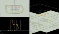 |
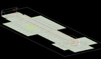
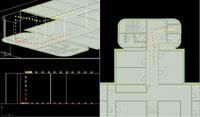
| The pedestrian navigation module (PNM) permits soldiers and first responders to navigate in areas where global positioning satellite signals cannot penetrate, such as in buildings. Fusing data from a variety of sensors, the PNM displays a user’s location and path of travel in three dimensions on a digital map. |
A recently developed individual navigation tool allows soldiers to know their precise location inside buildings or areas where global positioning satellite signals are jammed. By combining several technologies into a small, lightweight unit, the device would provide warfighters with a three-dimensional view of their position so they could retrace their path to exit an area. The equipment also could help civilian first responders such as fire, police and emergency personnel to find routes through damaged or smoke-filled buildings.
Determining an exact location in relation to other units or individuals is often the first and most important aspect of situational awareness. This sense of geography is especially crucial for small teams of soldiers operating in urban areas or in rugged or heavily forested terrain. In recent years, technologies such as handheld global positioning system (GPS) devices and digital maps have made traveling in such environments easier, safer and more accurate. However, GPS signals do not reach into places such as large buildings, basements and sewer systems, and some nations have developed electronic countermeasures that can jam GPS transmissions. A blind navigation capability would permit troops to determine their location regardless of their immediate electromagnetic environment.
One company providing this technology is Vectronix AG, Heerbrugg, Switzerland. Its device, known as the pedestrian navigation module (PNM), fuses data from several different sensors with proprietary software optimized for foot travel. According to Jeff Slusher, president of the firm’s U.S. business unit, Vectronix Incorporated, in Leesburg, Virginia, development of the PNM concept began in late 2002.
The device is slightly larger than a pack of cigarettes and is designed to fit in the small of a user’s back. It is battery powered and contains a digital compass with built-in accelerometers, a rate gyroscope, a barometer and proprietary software. Movement and direction are recorded by the accelerometer, compass and sensors placed at the user’s knees, Slusher says. The barometer measures altitude changes such as going up or down flights of stairs. The software then combines this data and displays it on a personal digital assistant (PDA)-type device that can be hand carried or attached to a Velcro mount on a user’s sleeve. Slusher notes that, in the final product, the PNM will provide a continuous moving map on the PDA. The company also is examining other types of visualization systems, such as helmet-mounted displays, but he cautions that this particular technique is only in the concept phase, and no prototypes have been built.
Digital maps of an area or region also can be loaded into the PNM, and the device can be fitted with an optional GPS receiver. Although it can provide GPS-free navigation, it is compatible with commercial and military GPS standards, Slusher maintains.
A key advantage of the PNM is that it functions in areas that cannot receive GPS signals. Slusher observes that the device has applications for special operations forces and police and fire departments operating in buildings or tunnels. “You would know the general direction you are moving in as well as the elevation,” he says.
Because the unit tracks movement, users can determine their location in a building via a digital map of the structure. Even without mapping data, they can retrace their path to exit. “It gets you out faster than any other system we’ve ever seen, other than laying down a piece of string,” he says.
Vectronix is working with Galaxy Scientific Corporation, Eatontown, New Jersey, and the U.S. Army’s Communications-Electronics Research and Development Engineering Center at Fort Monmouth, New Jersey. Slusher notes that his company is supplying Galaxy, the prime contractor, with the PNM for this program. Vectronix also is in discussions with the Army’s Special Operations Command at MacDill Air Force Base, Florida. In addition, the Army recently tested the PNM at Fort Hood with positive results. Commensurate with the appropriate military requirements, he hopes to begin producing PNM units in the next 24 to 36 months.
The company is examining civilian applications for the device as well. Vectronix has sold some of its units to the Sendero Group, Davis, California, which specializes in designing navigation aids for the blind.
Vectronix is seeking business opportunities in Europe, where it is working with Rockwell Collins, U.K., to incorporate PNM technology in the British Army’s Future Integrated Soldier program. The firm also is in discussions with other nations to include the technology in their advanced soldier systems programs, Slusher explains.
Web Resources
Vectronix: www.vectronix.ch
U.S. Army Communications-Electronics Research and Development Engineering Center: www.monmouth.army.mil/cecom/rdec/rdecDA.html
Galaxy Scientific Corporation: www.galaxyscientific.com/areas/ps.htm
U.S. Army Special Operations Command: www.socom.mil


Comments