Satellite Images Show Devastation of Deadly Earthquake in Italy
Shortly after getting word of the deadly earthquake that has devastated much of central Italy, the European Space Imaging's satellite tasking operations team collected the first satellite image of the damage at 10:21 a.m. (UTC).
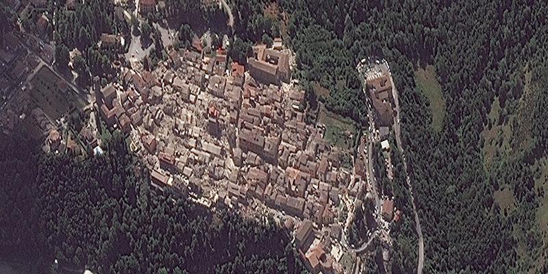
Shortly after getting word of the deadly earthquake that has devastated much of central Italy, the European Space Imaging's satellite tasking operations team collected the first satellite image of the damage at 10:21 a.m. (UTC).
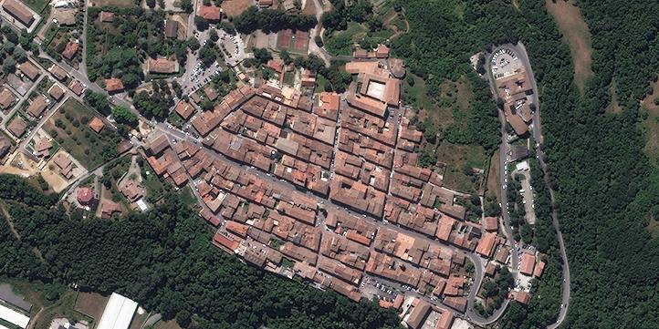
Comparing the high-resolution satellite image taken on August 9, 2010, viewers clearly see the effects of the earthquake in the town center of Amatrice.
A 6.2-magnitude earthquake hit central Italy on Wednesday about 65 miles northeast of Rome. Many of the dead, which by early evening local time tallied 120, were in the historic town of Amatrice. The mayor reportedly stated that three-quarters of the town was destroyed.
Tremors were reportedly felt across the European nation, from Bologna in the north to Venice in the east and just south of Rome in the south. Officials have reported dozens of aftershocks.


Comments